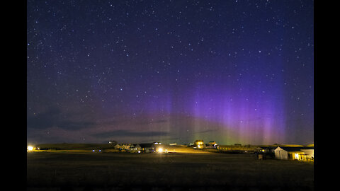
Aurora Storm from Cheyenne, WY: 4 Nov 21
Just before dawn this northern lights display peaked.
15
views
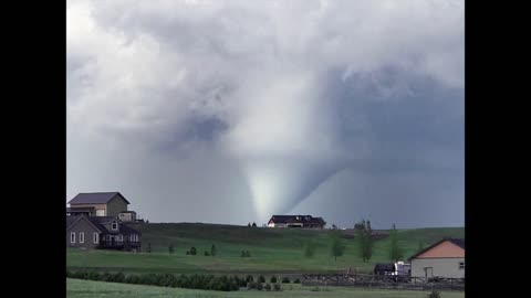
North Cheyenne Wyoming Tornado: 12 Jun 17
Using several cameras, I attempted to capture various aspects of a severe thunderstorm that ultimately produced a very photogenic but short lived tornado. I highlighted features in the structure of the storm for those with less meteorology background. This was my first time witnessing and imaging a live tornado. My area was spared baseball size hail, heavy downpours, and damaging winds as the forming tornado just passed one mile west of me. I recorded video handheld in somewhat dangerous conditions and you can see the sped up time lapse bouncing all over; but you get the idea. I hope you enjoy watching this rather interesting weather event.
32
views
Mullen Wild Fire over SE Wyoming
The Mullen Fire is a wildfire that has burned (beetle killed spruce and pine) over 176,840 acres (71,560 ha), 28 miles (45 km) west of Laramie, Wyoming. The fire started on September 17, 2020 in the Savage Run Wilderness of Carbon County, and spread to Albany County. On September 30, it spread into Jackson County, Colorado. The cause is unknown. It burned close to the Rob Roy Reservoir, and Platte River Wilderness. On October 15, 2020, the fire was estimated to span 25 miles north to south, and 23 miles east to west.
In Cheyenne, Wyoming, air quality reach hazardous levels several times during the period from 17 September - 21 October. Satellite image clearly shows the afternoon explosion of smoke over southeast Wyoming. Several large fires south of the Mullen Fire are clearly evident in northern Colorado.
Telephoto images/video taken over 70 miles away shows the convective nature of the billowing smoke.
14
views
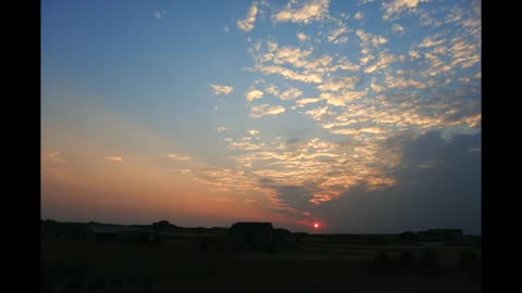
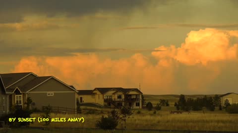
Thunderstorms at Sunset
Scattered thunderstorms throughout the day moistened the air so that at sunset, with a clear western horizon, clouds to the east received intense sun's rays. This resulted in a rather colorful sunset as lightning occasional flashed. This time lapse covers nearly 1h45m and is sped up 20x. Music by Tryad entitled "The Rising". You can download their FREE MUSIC at: https://www.jamendo.com/artist/104/tryad?language=en
1
view
Hail Shaft & Thunderstorm Sunset
June 16th, 2016 the hottest day so far this year and thunderstorms popped up late afternoon to my northwest. This sequence was more than 2.5 hours long as an intense thunderstorm just passed northeast of me with a rather well defined hail shaft (white falling from the clouds). This system was moving to the ESE at only 10 mph. As it moved east at sunset, the thunderstorm brightened to almost blinding intensity. Shortly thereafter, a very intense lightning storm developed: https://www.flickr.com/photos/79387036@N07/26984189344/in/dateposted-public/
Music: Empty by Tryad (public domain)
28
views
1
comment

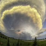
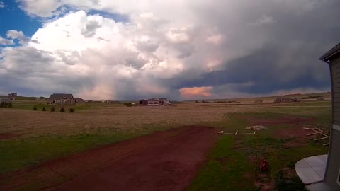
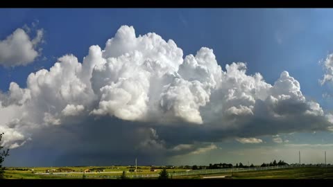
Another Stormy Day: 9 Jul 21
July 9, 2021 was a day with severe weather, thunderstorms, lightning, mammatus clouds, and more.
14
views

Severe THunderstorm: 14 Jul 21
A stationary front along the Wyoming/Colorado border provided strong instability for an array of weather events.
I've included two satellite loops showing two particularly severe thunderstorms and what they looked like at ground level.
The first storm dropped golf ball size hail but turned away at the last minute and I was spared. This rain/low cloud storm was not very photogenic. However, the 2nd storm produced beautiful mammatus both before and after the storm passed by.
The day ended with a nice fire sky sunset.
25
views
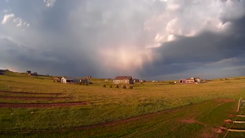
Another Stormy Day: 15 Jul 21
Several severe thunderstorms moved through this active weather day. The 2nd storm was a really close call as I was on the edge of it for over an hour.
At the end of the day, mammatus clouds formed under a well developed anvil.
Dark Star by Kevin MacLeod is licensed under a Creative Commons Attribution 4.0 license. https://creativecommons.org/licenses/by/4.0/
Source: http://incompetech.com/music/royalty-free/index.html?isrc=USUAN1100534
Artist: http://incompetech.com/
25
views
When Wildfire Smokle Arrives
I really dislike smoke. Besides, health related issues, it just kills most photo opportunities. However, smoke, just like fog could be a photographer's friend.
Although wildfire smoke can hide distance clouds such as thunderstorms, the smoke particles can actually prevent storms from forming. If there is any good news in all this, it is that smoke can enhance colorful sunrises and sunsets, cause the moon to be blue to red, and can produce crepuscular rays.
This very short video highlights the hidden beauty that smoke brings to the skies. For the record, I'd rather not have our forests and grassland ablaze.
Taken during the 3rd week in July 2021 for Cheyenne, Wyoming.
Prelude No. 16 by Chris Zabriskie is licensed under a Creative Commons Attribution 4.0 license. https://creativecommons.org/licenses/by/4.0/
Source: http://chriszabriskie.com/preludes/
Artist: http://chriszabriskie.com/
24
views
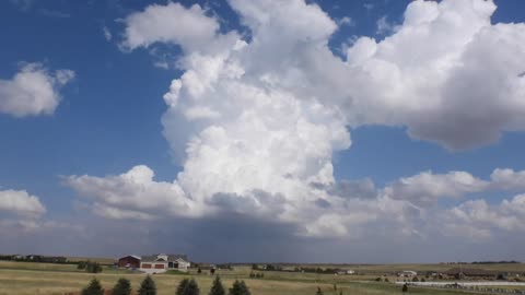
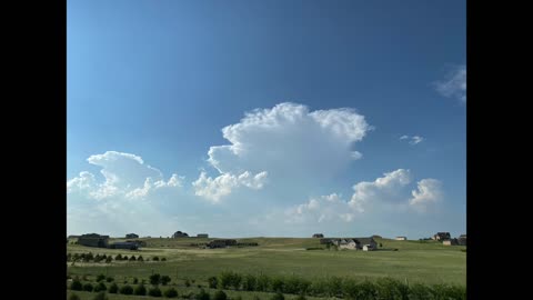
Isolated Storm of 29 Jul 21
This isolated thunderstorm was 10 miles from me with the edge of the anvil overhead. This storm was about 10 miles in diameter and the closest lightning strike was 7.5 miles away. It lasted for about 1 hour before dissipating.
This thunderstorm was difficult to photograph because it was very close and mid-level clouds obscured its developed at times.
The cell exploded with beautiful thunderhead formation.
14
views
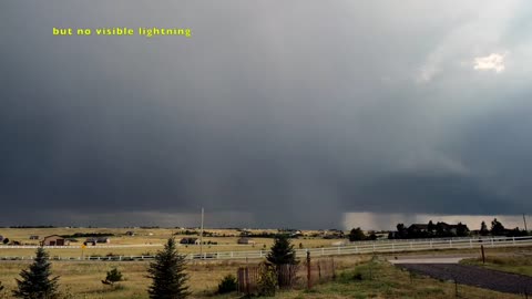
Severe Storm: 14 Aug 21
This cell went from nothing on radar to a severe thunderstorm in less than 10 minutes around 7PM. I heard a low rumble of thunder overhead (no lightning) but after just 3 minutes, I heard what sounded like a continuous moving freight train just to my north. It was hail hitting my neighbor's homes and outbuildings. Within 2 minutes +1 inch hail with no rain started to fall. The sound was now deafening. However, being on the western most edge of this storm, the hail ended in just 7 minutes.
A few minutes later I captured classic hail shafts. Boy did it sting when I went to retrieve my other camera. This single cell eventually split and remained visible for another 90 minutes as it moved south-southeast.
In this clip you will see satellite, radar, and various time lapse, panorama, and real-time video as the events unfolded. Enjoy!
Music for this video:
Comic Plodding - Silent Film Dark by Kevin MacLeod is licensed under a Creative Commons Attribution 4.0 license. https://creativecommons.org/licenses/by/4.0/
Source: http://incompetech.com/music/royalty-free/index.html?isrc=USUAN1100457
Artist: http://incompetech.com/
17
views
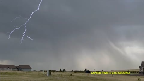
Electrical Storm: 6 August 2021
The human eye can see at a frame rate of 1/10th of a second, so the finer details are missed. Even at the standard 24 to 30 fps movie, much of this event would not be recorded.
Between 6:42PM and 6:54PM, I stood in my garage as I captured a nice electrical storm just 1 to 3 miles away. Using a iPhone 11 Pro Max in slow motion mode, I slowed the strikes to 1/10th real time.
If a strike was faster than 1/24th of a second, there was a good chance I'd miss it if I took a normal video. However, at 240 fps, many strikes were recorded with remarkable detail. I was holding the iPhone as the storm moved by.
11
views
Distant Storms: 23 August 2021
For Wyoming, the thunderstorm season usually end abruptly around Labor Day so my storm videos might be coming to an end soon. However, on August 23, after afternoon showers moved through, they intensified by evening some 80 to 100 miles to my east over the Nebraska Panhandle.
Despite this great distance, I was able to capture these storms using my Nikon Coolpix P950 super telephoto camera and my Fujifilm X-T3 in video mode using a Nikkor 85mm F/1.4 lens at high iso = 6400!
Gnarled Situation by Kevin MacLeod is licensed under a Creative Commons Attribution 4.0 license. https://creativecommons.org/licenses/by/4.0/
Source: http://incompetech.com/music/royalty-free/index.html?isrc=USUAN1100405
Artist: http://incompetech.com/
10
views
Weather Events of 3 Sep 21
Not every severe thunderstorm are alike. This short clip shows two thunderstorms; one just missing and the other a direct hit. The 1st generated continuous thunder for an hour without any apparent lightning visible to my eyes. The 2nd storm generated a classic roll cloud that I captured in time lapse. Stay for the end of this upload to hear the sounf of what continuous thunder sounds like.
This will probably be my last thunderstorm video for 2021 but stay tuned for more winter storm clips.
Music in this video
Song: It's Coming
Artist: Josh Kirsch/Media Right Productions
Album: It's Coming
Licensed to YouTube by
YouTube Audio Library
44
views
1
comment
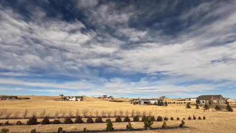
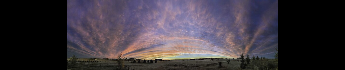
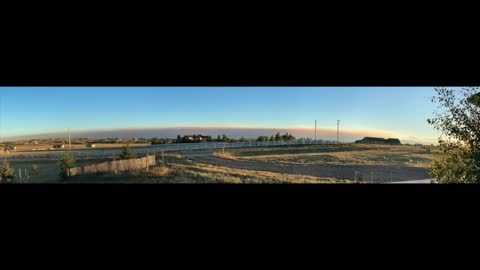
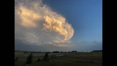
Clouds of the Day: October 30, 2021
After a clear sky sunrise, a cold front moving south out of Montana helped to create unusual clouds. Strong winds caused several mountain wave and lenticular clouds. Eventually lower clouds moved south as higher clouds continued to move north.
38
views