Wow! Christmas BLIZZARD Potential with ARCTIC VORTEX Surging into Great Lakes Region
**BE ON ALERT THURSDAY THROUGH SATURDAY (Dec. 22-24)**
A Pacific Low will surge ahead of an arctic vortex from Siberia moving into the United States. The storm will undergo dramatic intensification as it reaches the eastern CONUS and fuel heavy snow across multiple areas in the northeastern U.S. Questions do remain as to exactly where low will undergo intensification, with the possibility of a more eastward track limiting winter storm impacts. However, latest models do appear to be trending more towards a Great Lakes Region impact with heavy snow accumulations possible in some spots. Behind the storm, arctic air surges in sending air temperatures tumbling into the teens. Potential blizzard-like conditions could occur with wind gusts reaching 40mph or higher along with additional snowfall. Lake effect snow could continue through Christmas Day across Michigan before the storm finally begins to shift farther north beyond the holiday. Arctic air with subzero wind chills will remain in place for at least a few days after Christmas before a thaw comes to end the winter blast in early January.
**This content is a model analysis for entertainment purposes, please refer to your local NWS forecast for up-to-date info**
LIKE and SUBSCRIBE for more weather-related content like this!
-
 4:21:46
Great Lakes Weather
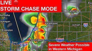
21 days ago $0.60 earnedLIVE STORM CHASE IN WEST MICHIGAN
540 -
 LIVE
LIVE
Revenge of the Cis
2 hours agoEpisode 1355: The Hero We Need
3,269 watching -
 1:57:02
Film Threat
7 hours agoVERSUS: THE ACOLYTE DESTROYS STAR WARS | Film Threat Versus
24.1K1 -
 13:11
13:11
Breaking Points
5 hours agoMacron Calls SNAP ELECTION After Right Wing EU SURGE
26.7K42 -
 2:00:08
Barstool Yak
5 hours agoThe Yak with Big Cat & Co. Presented by Rhoback | The Yak 6-10-24
30.7K58 -
 54:59
54:59
Ben Shapiro
5 hours agoEp. 1982 - Israel Pulls Off MIRACLE Rescue Of 4 Hostages…And The Left Laments
67.3K231 -
 43:38
43:38
Bright Insight
5 hours agoYou Won’t Believe This Disturbing Gobekli Tepe Update
47.1K114 -
 1:31:00
The Kevin Trudeau Show
3 hours ago10 Steps To Manifest Anything You Want | The Kevin Trudeau Show | Ep. 20
25.5K4 -
 1:09:31
Russell Brand
7 hours agoBird Flu Pandemic SCAM?! New Lockdowns + Vaccines!
147K380 -
 2:56:24
The Charlie Kirk Show
5 hours ago2016 Redux + George Janko On-Set | Habba, Kassam, Janko | LIVE 6.10.24
122K49