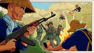
The Showdown in the Iron Triangle | Battlefield S3/E4 | Battlefield Vietnam
If you want to support our channel, I will be very grateful. PayPal: viktor3177@inbox.lv
Friends! If you liked this video, be sure to like and subscribe to the channel!
The Iron Triangle was an important strategic location, bounded on the north by the jungle and overgrown rubber plantations of the Long Nguyen Secret Zone, on the west by the Saigon River and on the east by the smaller but unfordable obstacle of the Thi Thinh River. Phú Cường, the capital of Bình Dương Province, was an important industrial and farming center and contained the ARVN Engineer School. It was linked by a major highway with the large ARVN Phu Loi Base Camp and, farther east, with Bien Hoa Air Base. Lying as it did in the center of the Saigon River corridor, at the junction of Highways 13 and 1, and only 16 km from the outskirts of Saigon, Phú Cường was vital to the defense of Saigon.
The terrain within the Iron Triangle was flat, almost featureless, and covered by dense brush and undergrowth. The clearings, especially in the northern part, were thick with elephant grass, higher than a man's head. The surface was scarred by countless bomb and shell craters so that vehicular movement off the narrow, rough dirt roads was nearly impossible; even tracked vehicles had difficulty. A vast network of tunnels and trenches, most of them caved-in and abandoned, laced this ground that had been the scene of battles since the First Indochina War.
A weak string of three ARVN outposts protected the northern edge of the Triangle, from Rach Bap (11.1287°N 106.516°E) on the west, close by the Saigon River, along local Route 7 to An Dien (11.148°N 106.586°E) on the Thi Thinh River opposite Bến Cát. Each of these outposts, including Base 82 (11.133°N 106.544°E), which was midway between Rach Bap and An Dien, was manned by a company of the 321st Regional Force (RF) Battalion. Another country road passed by the Rach Bap outpost, local Route 14, which generally paralleled the Saigon River from Tri Tam, through Rach Bap, and veered to the southeast through the Triangle, crossing the Thi Thinh River before it joined Highway 13 north of Phú Cường. The PAVN had blown the bridge on Route 14 over the Thi Thinh a few weeks earlier, but the stream could be spanned by pontoon sections. About midway between Rach Bap and the Thi Thinh crossing of Route 14, the ARVN had another small firebase.
Frequent sweeps and some semi-fixed defensive positions north of Củ Chi manned by the ARVN 25th Division and Hậu Nghĩa Province RF screened the western flank of the Triangle, but PAVN resistance in the Ho Bo Woods opposite Rach Bap and the formidable obstacle of the Saigon River, as well as a lack of resources, limited the influence that the 25th could exert on the situation within the Triangle. The ARVN was strong with infantry, armor, and mutually supporting fire bases and outposts in Bến Cát District east of the Thi Thinh boundary of the Triangle, but only one bridge, a weak span, connected the district town and the Triangle hamlet of An Dien.
-
 56:04
56:04
History of the World
3 months agoThe Tet Offensive | Battlefield S3/E6 | Battlefield Vietnam
271 -
 56:03
56:03
History of the World
3 months agoRolling Thunder | Battlefield S3/E10 | Battlefield Vietnam
6 -
 19:35
19:35
MAGA Lion HAT
1 year agoVietnam War from the North Vietnamese Perspective | Animated History 💥🔫
208 -
 14:04
14:04
The Memory Hole
1 year agoCIA Archives: The Strategic Hamlet Program in the Vietnam War (1963)
954 -
 59:31
59:31
The Memory Hole
1 month agoThe Forgotten China-Vietnam War
851 -
 7:02
7:02
UpbeatTraveler
2 years ago $0.16 earnedHoa Lu Ancient Capital, Ninh Binh, Vietnam
427 -
 4:57
4:57
The Memory Hole
1 year agoCIA Archives: Anti-Aircraft Guns Around Hanoi (1972)
4.25K1 -
 5:35
5:35
backinnam1975
1 year agoSoldiers and Royalty during the Nguyen Dynasty in Vietnam (1802-1945) historical images Phụ đề TV
1 -
 7:17
7:17
videocuatuihonvietbiz
6 years agoCan Tho Bridge - South Vietnam
30 -
 0:53
0:53
US ARMY
6 months agoReliving History: US Army's Epic Battle in La Drang Valley, Vietnam
32