Google Maps to roll out feature to show COVID-19 infection rates
Loading comments...
-
 0:57
0:57
KTNV
3 years agoResearchers using Google Street View to understand infection rates
45 -
 0:24
0:24
KTNV
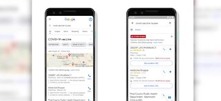
3 years agoGoogle Maps helps you find COVID vaccines easier
39 -
 1:48
1:48
KGTV
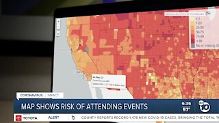
3 years agoResearchers create COVID-19 risk assessment map
671 -
 1:03
1:03
Digital Trends
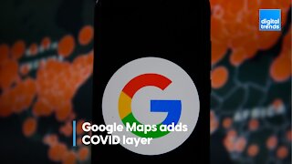
3 years agoGoogle Maps is adding a COVID layer
41 -
 1:48
1:48
KJRH
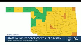
3 years agoState health department launches color-coded COVID-19 risk map
170 -
 0:48
0:48
New York Post
4 months agoDocs show Chinese lab had COVID-19 mapped two weeks before global outbreak
3.92K4 -
 1:00
1:00
NarcityCanada
3 years agoCanada's New COVID-19 Hotspot Map Has So Many More Places With High Infection Rates
8.59K -
 1:00
1:00
Digital Trends
4 years agoApple Maps has added COVID-19 testing sites for the entire U.S
18 -
 2:53
2:53
KERO
3 years agoKern County Public Health increases contact tracing as COVID-19 cases rise
20 -
 2:00
2:00
KSHB
4 years agoKansas City-developed app would alert you to potential COVID-19 exposure
19