Ophir Creek to Painted Rock | Tahoe Rim Trail With a Dog June 2021| Episode 4
Follow me:
https://www.instagram.com/skibum96/
~~Timestamps~~
00:00 Intro
01:00 Glacier on the Tahoe Rim Trail?
01:30 Is this the best view in North shore of Lake Tahoe?
02:48 Bolsa root meadows
03:30 Nevada/California TRT crossing
04:00 Waves of blue. How is my body doing?
05:30 Revive GPS Track. Ophir Creek to Painted Rock
06:00 Half way done with the Tahoe Rim Trail!
06:35 Brockway Summit to Watson Lake
07:00 Watson lake view of Lake Tahoe
07:50 Revive GPS track. Brockway Summit to Painted Rock,
08:18 Interview with 'Different Socks' 17,000 miles hiked
10:24 End
ASCEND TO THE HIGHEST POINT ON THE TRT
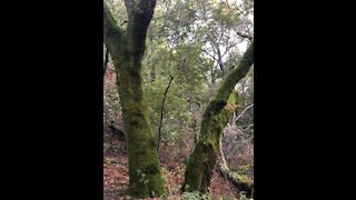
Between Brockway and Tahoe Meadows, the TRT winds through thick forests, open meadows, and across the feet of ancient volcanoes. In springtime fields of yellow mules ears sparkle against the backdrop of Lake Tahoe. This segment is prized for its spectacular windswept vistas of Lake Tahoe, the Sierra and the Carson Range.
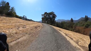
The trail climbs away from Brockway for several miles and into thick and fragrant stands of pine, fir and tobacco brush. It crosses sun-splashed meadows where bright wildflowers are backed by distant lake views. The interior of the segment enters Nevada and the Humboldt-Toiyabe National Forest and treks along the volcanic summits and slopes of the Mt. Rose Wilderness and includes the highest point on the TRT, 10,338′ Relay Peak. Long ridge traverses afford horizon-spanning, nearly continuous views south across the entire Tahoe Basin and northwest over the Sierra to Mt. Lassen and beyond.
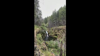
As the route leaves the Wilderness, crossing a saddle where the views change from the west to the east, a 0.7 mi spur trail ascends to the summit of 10,490′ Mt Houghton, offering expansive views in all directions. Continuing on, towering pines reappear to shelter the trail along its descent to the base of a 130′ waterfall, the highest on the trail. Hikers pass the junction of the trail to the top of Mt. Rose, then continue to the parking lot at the Mt. Rose trailhead.
BIG VIEWS AND CURIOUS LAVA FORMATIONS
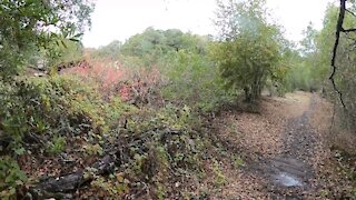
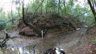
Between Tahoe City and Brockway Summit, the Tahoe Rim Trail meanders through groves of fir, cedar and aspen and across open hillsides covered with manzanita. The trail climbs steadily from Tahoe City into a mixed forest. Side trails and open slopes offer opportunities to explore cinder cones and ancient lava flows. Midway between the trailheads the terrain flattens and a denser forest provides cool, quiet shade. The trail continues past the Lava Cliffs, a lovely overlook of Lake Tahoe and the peaks lining its north shore, before dropping down to Watson Lake. This shallow lake is thickly fringed with wildflowers in spring and early summer, and is a pleasant spot for fishing, picknicking and camping. Between Watson Lake and Brockway the trail crosses gently rolling slopes covered with a patchwork of small meadows and thick forests.
-
 21:24
21:24
Alpine Hiker
2 years agoPainted Rock to Big Meadow | Tahoe Rim Trail Thru Hike With a Dog June 2021| Episode 6
161 -
 14:47
14:47
Alpine Hiker
2 years agoThru Hiking the Tahoe Rim Trail with a dog! Episode 2
18 -
 10:08
10:08
Alpine Hiker
2 years agoThru Hiking the Tahoe Rim Trail with a dog! Episode 1
45 -
 10:43
10:43
Alpine Hiker
2 years ago $0.01 earnedThru Hiking the Tahoe Rim Trail with a dog! Episode 3
73 -
 1:12
1:12
burgessj99
2 years agoBear Creek Trail
50 -
 1:15
1:15
burgessj99
2 years agoBear Creek Trail Timelapse
123 -
 0:10
0:10
Seanhissong
2 years agoEagle creek trail waterfall
23 -
 1:27
1:27
burgessj99
2 years agoMount Diablo Creek Trail
548 -
 0:41
0:41
burgessj99
2 years agoMount Diablo Creek Trail
21 -
 2:01
2:01
burgessj99
2 years agoHiking Bear Creek Trail
36