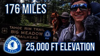
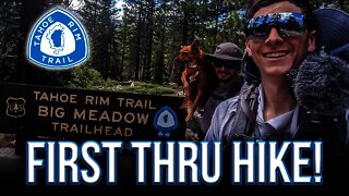
Thru Hiking the Tahoe Rim Trail with a dog! Episode 3
ENJOY THE MOST PHOTOGRAPHED SPOT ON THE TRT
Follow me:
https://www.instagram.com/skibum96/
~~Timestamps~~
00:00 Intro
00:42 Prettiest stretch of the Tahoe Rim Trail?
00:50 GPS track
01:00 Is this Heaven?
01:44 Flume Trail
02:52 Cute Doggo
03:25 Gps Track day 5 Ophir Creek to Brockway Summit.
04:52 Mt Rose Water Fall - last water for 15 miles
05:30 Relay Peak- Best views
10:00 Is that a Cave?
10:42 end
Between Tahoe Meadows (8740′) and Spooner Summit (7150′), the TRT roams high above sparkling Lake Tahoe and Marlette Lakes, through sun-warmed conifer stands, and across steep, flower-strewn slopes. This segment is celebrated for its magnificent views, stretching across Lake Tahoe and the high Sierra and past the jagged ranges of the Great Basin. The route is rich in historical reminders, skirting lakes and flumes built to supply water to distant miners on the Comstock. It traverses both dense forests that sprang up after clear-cutting a century ago, and ancient red fir stands spared the ax by their remoteness.
Between the lush grasses of Tahoe Meadows and Twin Lakes, the trail winds through rolling, wooded terrain. Breaks in the trees showcase grand vistas of the Tahoe Basin and Washoe Valley. The steeper, often open interior of the segment travels through Lake Tahoe Nevada State Park including possible side trips to North Canyon Campground and Marlette Lake. A TRT spur leads to Christopher’s Loop and a glorious cliff perch that seems to float above Lake Tahoe’s translucent shallows and Sand Harbor at the trail’s most photographed spot. The trail segment reaches its highest point as it threads between the bare rock of Snow Valley Peak (9214′) and shimmering aspen groves that turn North Canyon to gold each fall. Near Spooner Summit, the trail slips back into the pines, but still offers occasional panoramic lake and valley views.
ASCEND TO THE HIGHEST POINT ON THE TRT
Between Brockway and Tahoe Meadows, the TRT winds through thick forests, open meadows, and across the feet of ancient volcanoes. In springtime fields of yellow mules ears sparkle against the backdrop of Lake Tahoe. This segment is prized for its spectacular windswept vistas of Lake Tahoe, the Sierra and the Carson Range.
The trail climbs away from Brockway for several miles and into thick and fragrant stands of pine, fir and tobacco brush. It crosses sun-splashed meadows where bright wildflowers are backed by distant lake views. The interior of the segment enters Nevada and the Humboldt-Toiyabe National Forest and treks along the volcanic summits and slopes of the Mt. Rose Wilderness and includes the highest point on the TRT, 10,338′ Relay Peak. Long ridge traverses afford horizon-spanning, nearly continuous views south across the entire Tahoe Basin and northwest over the Sierra to Mt. Lassen and beyond.
As the route leaves the Wilderness, crossing a saddle where the views change from the west to the east, a 0.7 mi spur trail ascends to the summit of 10,490′ Mt Houghton, offering expansive views in all directions. Continuing on, towering pines reappear to shelter the trail along its descent to the base of a 130′ waterfall, the highest on the trail. Hikers pass the junction of the trail to the top of Mt. Rose, then continue to the parking lot at the Mt. Rose trailhead.
-
 10:08
10:08
Alpine Hiker
2 years agoThru Hiking the Tahoe Rim Trail with a dog! Episode 1
45 -
 14:47
14:47
Alpine Hiker
2 years agoThru Hiking the Tahoe Rim Trail with a dog! Episode 2
18 -
 9:26
9:26
Double Nickel Road Trip
1 year ago $0.01 earnedGRAND CANYON OVERLAND WITH MY BERNESE MOUNTAIN DOG•ADVENTURE TO THE NORTH RIM//S1•EPISODE 28
766 -
 9:26
9:26
Double Nickel Road Trip
1 year agoIDAHO OVERLAND- MEET MY NEW BERNESE MOUNTAIN DOG PUPPY AND OVERLAND COMPANION//S1•EPISODE 25
5121 -
 25:26
25:26
Coleman Outdoors
2 years ago3 Day Solo Backpack | Hoover Wilderness | Robinson Creek Trail Loop 2020
258 -
 16:20
16:20
Double Nickel Road Trip
1 year ago $0.04 earnedWILD OVERLAND JOURNEY DOWN THE BLUE RIDGE PARKWAY///S1•Episode 13
185 -
 4:40
4:40
San Diego Real Estate
3 years agoYour Neighborhood with Kimo Quance (EPISODE 5: Carlton Hills & Carlton Oaks) | Kimo Quance
119 -
 4:59
4:59
San Diego Real Estate
3 years agoYour Neighborhood with Kimo Quance (EPISODE 10: BLOSSOM VALLEY)
73 -
 4:20
4:20
San Diego Real Estate
3 years agoYour Neighborhood with Kimo Quance (Episode 11: Big Rock)
34 -
 6:35
6:35
Double Nickel Road Trip
1 year ago $0.06 earnedThe Epic Journey Begins: Overlanding Maine's Coast with My Bernese Mountain Dog! //S1•EPISODE 29
1.09K2