Pictured Rocks National Lakeshore (Michigan) Print Review
Get it on Amazon here... http://geni.us/kOzVN
Get the frame here... http://geni.us/uLyU3rW
Join this channel to help me bring you more vids...
https://www.youtube.com/channel/UCS-ix9RRO7OJdspbgaGOFiA/join
Join the free von Panda group here... https://panda-research-institute.mn.co
Get Peter von Panda gear here... https://petervonpanda.storenvy.com/
Instagram... https://www.instagram.com/petervonpanda/
As an Amazon Associate I earn from qualifying purchases.
If you're seeking the perfect art to frame for your home or office, we're certain we have a piece you will connect with. Peruse our collection here, featuring thousands of available images in multiple sizes and mediums. We'd also like to take this time to thank you if you've purchased from us before, or plan to today. You are supporting artists who care deeply about their art form, and a company that is proud to print these amazing images in America. Your support allows us to continue doing what we love - creating beautiful art.
This size print is a statement piece and will be large enough to show detail and capture the attention of the viewer. Framing is readily available at any framer and many online frame suppliers. Printed on a heavy stock on our high-end digital printing press. We use only fine art inks, which are resistant to fading at least 75 years, museum-quality archival quality, with acid-free pigment to ensure the print doesn't discolor over time. We ship this print rolled in a thick mailer tube.
Pictured Rocks National Lakeshore is a U.S. National Lakeshore on the shore of Lake Superior in the Upper Peninsula of Michigan, United States. It extends for 42 miles (67 km) along the shore and covers 73,236 acres (114 sq mi; 296 km2). The park has extensive views of the hilly shoreline between Munising and Grand Marais in Alger County, Michigan, with picturesque rock formations, waterfalls, and sand dunes.
Pictured Rocks derives its name from the 15 miles (24 km) of colorful sandstone cliffs northeast of Munising. The cliffs reach up to 200 feet (60 m) above lake level. They have been naturally sculptured into a variety of shallow caves, arches, and formations resembling castle turrets and human profiles. Near Munising, visitors can also visit Grand Island, most of which is included in the separate Grand Island National Recreation Area.
The U.S. Congress designated Pictured Rocks the first National Lakeshore in the United States in 1966. It is governed by the National Park Service (NPS), with 22 year-round NPS employees as of May 2006, and received 476,888 visitors in 2005.
Although the Pictured Rocks shore waters are a rich fishing ground, the sandstone cliffs are dangerous to canoes and other open boats skirting the coastline. In 1658, the fur trader Pierre Esprit Radisson made this risky passage and noted that his Native American companions made an offering of tobacco to the local spirit of the cliffs.
During the Romantic Era of the 1800s, a series of American writers described their feelings upon sight of the Pictured Rocks. Geologist and US Indian Agent Henry Rowe Schoolcraft visited in 1820 and remarked upon "some of the most sublime and commanding views in nature".[3] In 1850, George Copway Kah-Ge-Ga-Gah-Bowh, a Mississaugas Ojibwa writer and Methodist missionary, published The Traditional History and Characteristic Sketches of the Ojibway Nation, in which he cited the detailed description of the Pictured Rock by General Lewis Cass.[4]:24–7 Around 1850, developers planned a tourist resort, Grand Island City, adjacent to the Pictured Rocks near the current site of Munising.
After the lumbering era ended around 1910, much of the land making up the current National Lakeshore reverted to the state of Michigan for unpaid property taxes. Eager for federal help and recognition, the state cooperated with the federal government in the region's redevelopment. In October 1966, Congress passed a bill authorizing the establishment of the Pictured Rocks National Lakeshore "in order to preserve for the benefit, inspiration, education, recreational use, and enjoyment of the public, a significant portion of the diminishing shoreline of the United States and its related geographic and scientific features."[5] This was America's first National Lakeshore.
On April 13, 2006, one of the named rock formations collapsed: the Inner Turret of Miner's Castle in the Munising Formation. The collapse was reported via cell phone by fisherman in the area, according to chief ranger Larry Hach. Miners Castle consists of crumbly cross-bedded sandstone poorly cemented by secondary quartz, according to Research Ecologist Walter Loope of the U.S. Geological Survey. Rockfalls along the cliffs typically occur in the spring and fall due to freezing-thawing action.
On March 30, 2009, the Omnibus Public Land Management Act was signed into law, protecting 11,740 acres (47.5 km2) of Pictured Rocks as the Beaver Basin Wilderness, spanning 13 miles of shoreline.[6]
-
 16:24
16:24
Robert Anthony Photography
2 years agoPictured Rocks National Lakeshore ~ Photography along The Michigan Shore of Lake Superior
1394 -
 3:27
3:27
Inspiring How UC That
1 year ago $0.03 earnedInteresting Places in Peninsula, OH. Bridges and Locks on the Cuyahoga River, Train Station & Depot
1521 -
 20:49
20:49
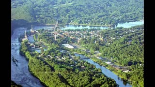
The Small Town Tourist
1 year agoWhen it comes to AMAZING Small Towns, SALTSBURG PA is a Hidden TREASURE
109 -
 21:28
21:28
Adventure Is Out There
11 months agoSearching For Cades Cove Black Bears While Biking In The Great Smoky Mountain National Park
27 -
 44:58
44:58
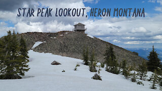
AOWS
2 years agoStar Peak Lookout - Cabinet Mountains, Montana
4521 -
 6:18
6:18
Art Beauty Photography & Videography
3 years ago $0.02 earnedSt. Louis Forest Park | The Jewel Box | Art Museum
194 -
 1:00
1:00
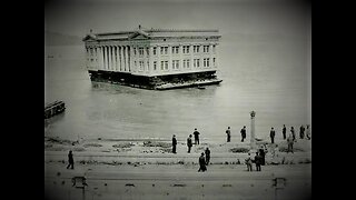
BrookeCerda
1 year agoChicago Was Chilaga (photos: before the world fair)
3.26K -
 10:52
10:52
TreasureRevealed
2 years agoTreasure Hunting in Hadley-Mt Holyoke-Titan Piazza-Methuen Massachusetts
350 -
 7:30
7:30
DecadenceAndDecay
3 years agoDeath & Souvenirs | Exploring Crow Butte, South Dakota | RuralEx and History Mini-Doc
273 -
 9:36
9:36
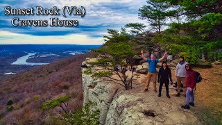
Hiking & Adventure
1 year ago $0.03 earnedBest Trail In Chattanooga, TN? | Hiking Civil War HISTORIC Cravens House To Sunset Rock
4442