

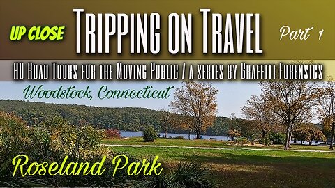
Tripping on Travel: Roseland Park Up Close, Woodstock, CT
We begin our UP CLOSE series of Roseland Park in Woodstock, Connecticut in the southern third of the park. Because on the Sunday I visited the park, it was busy with visitors, all of whom I generally avoid in my videos. Nature doesn't reveal itself with the sounds of birds in this segment. I occasionally heard what sounded like an aluminum baseball bat hitting a ball. Of no surprise really, given an adjacent baseball field nearby. A few times, I lowered the volume temporarily due to the breeze hitting the camera mic. And my footsteps can be heard sometimes as I walk over fallen, dry leaves. I was attracted to a tree you will see in the video, because unlike many tree species in New England, it grew straight up to the top without any branches from it's side. And with no evidence any were removed. If you watch closely, as I exit the wooded area, you can see in the background a portion of Roseland Lake and the trees on it's opposite shore.
The park is described by it's website as "390 acres of forested land, manicured lawns, sports fields, fishing dock, and playgrounds. The park abuts the 94-acre Roseland Lake". I only cover a mere fraction of the entire park. It's origin traces back to 1876, eleven years after the end of the American Civil War, and it's founder, "influential New York merchant, publisher, abolitionist and philanthropist", Henry C Bowen. He originally used the park to host annual Fourth of July parties. At that time, Bowen charged a small entrance fee, and accommodated parking for 1200 horse and buggies. "In Victorian days, the Park sported more than 1,000 rosebushes, gilded fountains, decorative statuary, wooded walking trails, a windmill, a boat house, dining room, and bungalows with maid service." Today, "Park facilities include a playground, basketball court, public golf course, amphitheater, group campground, pavilion, benches, boat launch, as well as the lake and event barn. Activities include: boating, fishing, picnicking, walking and running. No swimming is permitted."
Kinetics by | e s c p | https://escp-music.bandcamp.com
Music promoted by https://www.free-stock-music.com
Creative Commons / Attribution 4.0 International (CC BY 4.0)
https://creativecommons.org/licenses/by/4.0/
References:
About the Park
http://www.roselandpark.org/about-the-park-2
Map by Bing Maps
Other Graffiti Forensics channels and pages
http://www.youtube.com/c/GraffitiForensics
https://www.facebook.com/GForensics/
https://www.bitchute.com/channel/graffitiforensics/
8
views
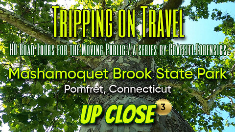
Tripping on Travel: Mashamoquet State Park #3, Pomfret, CT
Part 3 has me moving away from the brook's shores and toward the open field where I take a closer look at a stone wall and a few trees. One thing besides nature's beauty that caught my eye ... a mass of flying insects seen in the sunlight, that I assume are parasitic in nature. Mosquitos, gnats? I don't know. The next and final part of this series will be a slide show of the still images I took inside this small area of Mashamoquet Brook State Park that day.
In this series, I segue to a different approach. The camera's eye is close to the ground, as if from an animal's perspective. There is only introduction music and no background music. I chose instead to feature the sounds of the park as I walked through a small section of it.
Wikipedia explains the history of the state park this way; "Mashamoquet Brook first came to the attention of the State Park Commission when former Pomfret resident Sarah Fay donated eleven and a half acres of the stream's hemlock-lined gorge to the state in 1918. In 1925, that parcel was combined with the Wolf Den, site of Israel Putnam's legendary wolf slaying, which the Daughters of the American Revolution had purchased in 1899. The donation of the Hotchkins Wolf Den Farm parcel in 1957 together with other purchases and gifts brought the park to its present size of over 900 acres." There is also a swimming area at the park. But as it's explained by the state's website for the park, it's been closed this season due to maintenance issues.
Twilight City by | e s c p | https://escp-music.bandcamp.com
Music promoted by https://www.free-stock-music.com
Attribution 4.0 International (CC BY 4.0)
https://creativecommons.org/licenses/by/4.0/
References:
Wikipedia profile of the park
https://en.wikipedia.org/wiki/Mashamoquet_Brook_State_Park
State of Connecticut's Mashamoquet website
https://portal.ct.gov/DEEP/State-Parks/Parks/Mashamoquet-Brook-State-Park
Map by Bing Maps
Other Graffiti Forensics channels and pages
http://www.youtube.com/c/GraffitiForensics
https://www.facebook.com/GForensics/
https://www.bitchute.com/channel/graffitiforensics/
10
views
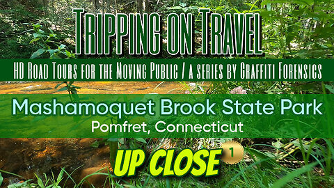
Tripping on Travel: Mashamoquet State Park, Pomfret, CT
In this footage, I segue to a different approach. The camera's eye is close to the ground, as if from an animal's perspective. There is only introduction music and no background music. I chose instead to feature the sounds of the park as I walked through a small section of it. In fact, in one segment, viewers will encounter a bumble bee among some small blossoms, complete with the sound of it's buzzing wings as it moves from blossom to blossom. This is essentially part one, because I have two or three other pieces of footage from the park to share, UP CLOSE. Wikipedia explains the history of the state park this way; "Mashamoquet Brook first came to the attention of the State Park Commission when former Pomfret resident Sarah Fay donated eleven and a half acres of the stream's hemlock-lined gorge to the state in 1918. In 1925, that parcel was combined with the Wolf Den, site of Israel Putnam's legendary wolf slaying, which the Daughters of the American Revolution had purchased in 1899. The donation of the Hotchkins Wolf Den Farm parcel in 1957 together with other purchases and gifts brought the park to its present size of over 900 acres." There is also a swimming area at the park. But as it's explained by the state's website for the park, it's been closed this season due to maintenance issues.
Jack the Lumberer by Alexander Nakarada | https://www.serpentsoundstudios.com
Music promoted by https://www.free-stock-music.com
Attribution 4.0 International (CC BY 4.0)
https://creativecommons.org/licenses/by/4.0/
References:
Wikipedia profile of the park
https://en.wikipedia.org/wiki/Mashamoquet_Brook_State_Park
State of Connecticut's Mashamoquet website
https://portal.ct.gov/DEEP/State-Parks/Parks/Mashamoquet-Brook-State-Park
Map by Bing Maps
Other Graffiti Forensics channels and pages
http://www.youtube.com/c/GraffitiForensics
https://www.facebook.com/GForensics/
https://www.bitchute.com/channel/graffitiforensics/
12
views
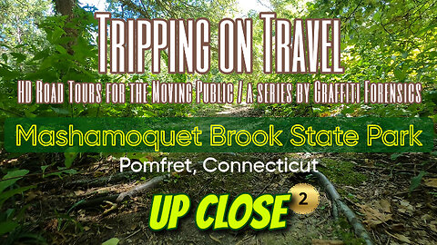
Tripping on Travel: Mashamoquet State Park #2, Pomfret, CT
In part 2 of this series, I make my way toward the old grist mill located near the entrance to Mashamoquet Brook State Park. More UP CLOSE footage of my visit will continue where I left off in my next upload.
In this series, I segue to a different approach. The camera's eye is close to the ground, as if from an animal's perspective. There is only introduction music and no background music. I chose instead to feature the sounds of the park as I walked through a small section of it.
Wikipedia explains the history of the state park this way; "Mashamoquet Brook first came to the attention of the State Park Commission when former Pomfret resident Sarah Fay donated eleven and a half acres of the stream's hemlock-lined gorge to the state in 1918. In 1925, that parcel was combined with the Wolf Den, site of Israel Putnam's legendary wolf slaying, which the Daughters of the American Revolution had purchased in 1899. The donation of the Hotchkins Wolf Den Farm parcel in 1957 together with other purchases and gifts brought the park to its present size of over 900 acres." There is also a swimming area at the park. But as it's explained by the state's website for the park, it's been closed this season due to maintenance issues.
Another Good Day by Keys of Moon | https://soundcloud.com/keysofmoon
Music promoted by https://www.free-stock-music.com
Attribution 4.0 International (CC BY 4.0)
https://creativecommons.org/licenses/by/4.0/
References:
Wikipedia profile of the park
https://en.wikipedia.org/wiki/Mashamoquet_Brook_State_Park
State of Connecticut's Mashamoquet website
https://portal.ct.gov/DEEP/State-Parks/Parks/Mashamoquet-Brook-State-Park
Map by Bing Maps.
Other Graffiti Forensics channels and pages
http://www.youtube.com/c/GraffitiForensics
https://www.facebook.com/GForensics/
https://www.bitchute.com/channel/graffitiforensics/
18
views
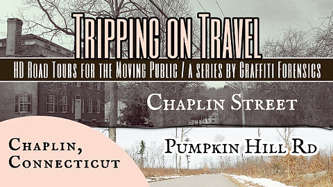
Tripping on Travel: Pumpkin Hill Rd, Chaplin, CT
I begin this video by turning onto Chaplin St in Chaplin, Connecticut, from Rt 198 N. The short street passes through Chaplin's Historic District, as one will notice as I drive past several old structures on both sides of the street. I did a little research looking for a haunting on Chaplin St but did not find anything online. The street ends and exits back onto Rt 198. Also off Rt 198, I take a drive up Pumpkin Hill Rd. Pumpkin Hill Rd in Chaplin includes a portion of Natchaug State Forest that is west of Rt 198. The part of the forest I visited in a prior video is located east of Rt 198. At the beginning of March, the trees were still bare and ground growth was still dormant. As you can see in the video, some parts of Pumpkin Hill Rd still had some snow on the side of the road. Everything looks rather desolate. There is also a Pumpkin Hill Wildlife Management Area known for it's several bird species and sightings. My footage ends where the online map I used said Chaplin's town line ends, at the northern edge of Natchuag State Forest. Once I passed that point, it shows me as being on Pumpkin Hill Rd in Ashford, CT. That footage will be in a subsequent video.
Mare Tranquillitatis by | e s c p | https://escp-music.bandcamp.com
Music promoted by https://www.free-stock-music.com
Attribution 4.0 International (CC BY 4.0)
https://creativecommons.org/licenses/by/4.0/
Maps of routes by Bing Maps. My only task was to trace my driving route from A (start) to B (end) to match the footage that follows it.
Other Graffiti Forensics channels and pages
http://www.youtube.com/c/GraffitiForensics
https://www.facebook.com/GForensics/
https://www.bitchute.com/channel/graffitiforensics/
14
views
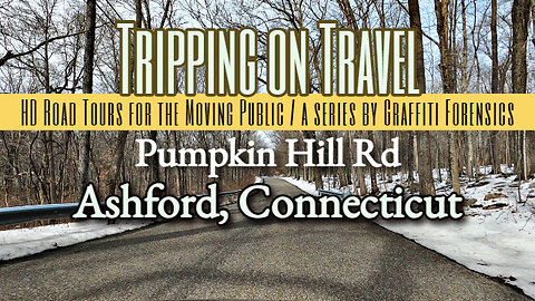
Tripping on Travel: Pumpkin Hill Rd, Ashford, CT
In this video, the footage picks up where it left off on Pumpkin Hill Rd in Chaplin. When, according to the map I used, I crossed Ashford's town line. My route, and the road, end at Rt 44. Ashford's greatest claim to fame may be actor Paul Newman's Hole in the Wall Gang Camp, located off of Rt 44. He was reportedly a seasonal resident of Ashford at some time prior to his death in 2008. Outside of that, I can tell you the town was incorporated in 1714. And it's resident population is smaller than many others in Connecticut. Recognizing how bleak Pumpkin Hill Rd looks in the footage in early March, I converted maybe 1 min of footage to black and white temporarily, and then brought back the color. Some viewers may find it a more appealing environment when they see the contrast between B&W and color.
Deep Valley2 by PeriTune | http://peritune.com
Music promoted by https://www.free-stock-music.com
Attribution 4.0 International (CC BY 4.0)
https://creativecommons.org/licenses/by/4.0/
References:
Ashford, Connecticut - Wikipedia
https://en.wikipedia.org/wiki/Ashford,_Connecticut
Ashford Town Hall website
https://ashfordtownhall.org/about/
Maps of routes by Bing Maps. My only task was to trace my driving route from A (start) to B (end) to match the footage that follows it.
Other Graffiti Forensics channels and pages
http://www.youtube.com/c/GraffitiForensics
https://www.facebook.com/GForensics/
https://www.bitchute.com/channel/graffitiforensics/
6
views
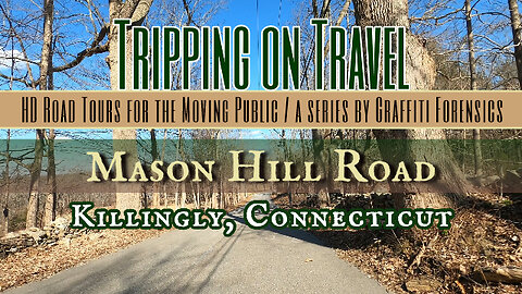
Tripping on Travel: Mason Hill Rd, Killingly, CT
Depending on what map or address you're looking at, Mason Hill Rd could be located in Ballouville village, Dayville, or Killingly. The first two are included in Killingly, CT so I went with Killingly as the location of Mason Hill Rd. The footage from last March takes me from the road's south entrance to my exit at it's northern end. Because the trees were still bare in March, and ground growth had not yet come back, I noticed while watching the footage that there are a lot of old-fashioned stone walls on Mason Hill Rd. As in stone masonry? I researched a bit to see if I could find the origin of the name of the road, but I did not. The Mason Hill Conservation Area can also be accessed from the road. It's described this way on Killingly's conservation website; "This 20-acre nature preserve was created with aid from Federal funding. View local flora and fauna as you walk the easy, 1-mile trail through woods and along meadows. Open to passive recreation. Leashed pets welcome."
Vopna by Alexander Nakarada | https://www.serpentsoundstudios.com
Music promoted by https://www.free-stock-music.com
Attribution 4.0 International (CC BY 4.0)
https://creativecommons.org/licenses/by/4.0/
References:
Mason Hill Conservation Area
https://www.killinglyconservation.org/mason-hill-conservation-area
Maps of routes by Bing Maps. My only task was to trace my driving route from A (start) to B (end) to match the footage that follows it.
Other Graffiti Forensics channels and pages
http://www.youtube.com/c/GraffitiForensics
https://www.facebook.com/GForensics/
https://www.bitchute.com/channel/graffitiforensics
80
views
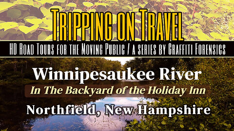
Tripping on Travel: Winnipesaukee River, Northfield, NH
In this footage, I simply walk behind the hotel I was staying at and showcase the view of the river's shoreline from their backyard. In one moment, I view the boat ramp across the river, as was referenced in my prior video regarding Shaker Rd. You'll notice the river is quite still at this location. In fact, the river around the hotel appears on the map as if it's a moat around the property. In this footage, there is no background music. I wanted to capture the actual sounds around me at the time, really because it was the last weekend of the annual "bike week" in the Lakes Region and I liked the contrast between the sounds of the motorcycles and the beauty of the natural surroundings.
The Streets Of Prague by Alexander Nakarada | https://www.serpentsoundstudios.com
Music promoted by https://www.free-stock-music.com
Attribution 4.0 International (CC BY 4.0)
https://creativecommons.org/licenses/by/4.0/
Maps of routes by Bing Maps. My only task was to trace my driving route from A (start) to B (end) to match the footage that follows it.
Other Graffiti Forensics channels and pages
http://www.youtube.com/c/GraffitiForensics
https://www.facebook.com/GForensics/
https://www.bitchute.com/channel/graffitiforensics/
4
views
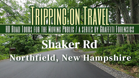
Tripping on Travel: Shaker Rd, Northfield, NH
The footage begins with me exiting the boat ramp parking lot found immediately after entering Shaker Rd. The history of Northfield on the town's website matches word-for-word some segments of Wikipedia's profile of the town. It's history tells us that the "north fields" farming community originated in an area that was part of the town of Canterbury, which in itself was established in 1841, twenty years BEFORE Abraham Lincoln was our President and the American Civil War began in 1861. Fifteen years after the end of the Civil War, however, 43 residents of the north fields of Canterbury submitted to the state their signed petition asking that they establish their own town, due to the long distance they had to travel for resources. Wikipedia explains that in the Northfield area, "early sawmills and gristmills gave way to large textile and paper mills. As these industries died out in the area, many old mill buildings were torn down. Others were used for the manufacture of other items, including optical lenses and lead batteries." But when viewing the scenery of Shaker Rd you'll see in this footage, you'll see it's beautiful, green countryside.
Mystventure by | e s c p | https://escp-music.bandcamp.com
Music promoted by https://www.free-stock-music.com
Attribution 4.0 International (CC BY 4.0)
https://creativecommons.org/licenses/by/4.0/
References:
Wikipedia - Northfield, New Hampshire
https://en.wikipedia.org/wiki/Northfield,_New_Hampshire
Town of Northfield
https://www.northfieldnh.org/about-us
Maps of routes by Bing Maps. My only task was to trace my driving route from A (start) to B (end) to match the footage that follows it.
Other Graffiti Forensics channels and pages
http://www.youtube.com/c/GraffitiForensics
https://www.facebook.com/GForensics/
https://www.bitchute.com/channel/graffitiforensics/
2.04K
views
Tripping on Travel: Bungay Hill Rd, Woodstock, CT
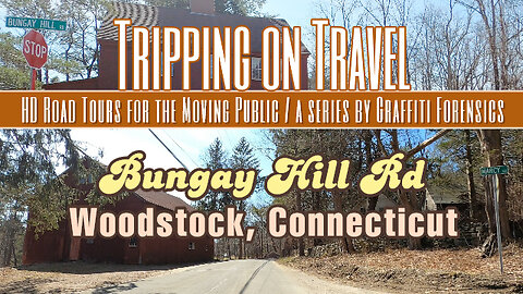
Video quality has been improved as of this production. In this video, I drive from beginning to end of Bungay Hill Rd in West Woodstock, Connecticut. As one can see from the map in the video, the road serves as a shortcut between Rt 171 on the east side of Lake Bungee and to Rt 198 located west of the lake. Very little about Bungee Lake is included in this video. At best, when I drove on Bungay Hill Rd, I drove past the very north end of Lake Bungee. You can get a brief glimpse of it in the video, but only as I drive by it. The spelling of the lake's name varies online. But I've always known it to be "Bungee". Some sources spell it as "Bunggee". A few sources use both spellings. Even maps will disagree. Bing shows it as "Lake Bungee", while others choose the two G spelling. Both Witches Wood Lake and Bungee Lake are "census designated places". Outside of that, there is not much to find about Lake Bungee's history.
Möbius Surface by | e s c p | https://escp-music.bandcamp.com
Music promoted by https://www.free-stock-music.com
Attribution 4.0 International (CC BY 4.0)
https://creativecommons.org/licenses/by/4.0/
Maps of routes by Bing Maps. My only task was to trace my driving route from A (start) to B (end) to match the footage that follows it.
Other Graffiti Forensics channels and pages
http://www.youtube.com/c/GraffitiForensics
https://www.facebook.com/GForensics/
https://www.bitchute.com/channel/graffitiforensics/
7
views
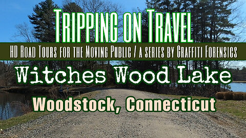
Tripping on Travel: Witches Wood Lake, Woodstock, CT
In this video, I enter Crooked Trail Ext from Rt 198, and follow it to Beaver Dam Rd and what is now a private beach. The name's origin has less to do with actual witches than it does an old statement by a local handyman who said supplies found in the former swamp years before were thrown there by witches. Tucked within the woodlands of West Woodstock, Connecticut, is a man-made lake attributed to Joe Campert, a local resident. As Margaret Houlihan explains in her online article, "The Man Who Made Witches Woods Lake", Joe was first involved in the adjacent Bungee Lake project that began in 1952. "In 1964, Joe started acquiring the Witches Woods Lake property from 4-5 landowners. Surveyors determined the shoreline, roads and high water mark before Joe touched a single tree. Jack Williamson and Oden Johnson helped Joe build Witches Woods Lake ... Eventually the lake was completed and the lots were sold by professionals. The Planning Zoning commission was resurrected and refused to allow Joe to put up any signs for Witches Woods Lake. He resorted to using cutouts of witches heads to help people find their way to the lake." Now, as told by the Lake Homes Realty website, "This lake covers 70.4 acres, is a mile long, and is about a fourth of a mile at its widest point. Located in Windham County, Witches Woods Lake is conveniently close to Connecticut’s border with Massachusetts." It allegedly still has two memorial beaches visitors and residents can enjoy. But in the case of this brief video and the route I took, the only beach I found is identified as private.
References:
"The Man Who Made Witches Woods Lake"
by Margaret Houlihan, March 2006
https://www.wwlake.com/lake-history-1
Lake Homes Realty; Witches Woods Lake, Connecticut
https://www.lakehomes.com/connecticut/witches-woods-lake
melt away by foxxy mulderr | https://www.foxxymulderr.com
Music promoted by https://www.free-stock-music.com
Creative Commons / Attribution 4.0 International (CC BY 4.0)
https://creativecommons.org/licenses/by/4.0/
Maps of routes by Bing Maps. My only task was to trace my driving route from A (start) to B (end) to match the footage that follows it.
Other Graffiti Forensics channels and pages
http://www.youtube.com/c/GraffitiForensics
https://www.facebook.com/GForensics/
https://www.bitchute.com/channel/graffitiforensics/
177
views

Tripping on Travel: Webster Lake vol 5 (final)
This footage begins with a drive down, and back, on Union Point Rd. It ends with footage as I travel down Memorial Beach Dr and I stop in a parking space near the water. While there is certainly a lot of well maintained beauty on Webster Lake, the lasting impression on me in this final volume of the series is the contrast between today's residents on the lake and the Nipmuc tribe that use to occupy the land, and depend on it's natural resources to thrive. The fact is, the decimation of the Nipmucs and their culture has been so thorough, that they were denied federal recognition in 2004, even while the State of Massachusetts did recognize them. European colonists in the 1600s, according to Wikipedia, "carried diseases, such as smallpox, to which the Native Americans had no immunity, and tribes in New England suffered high mortality rates to these infectious diseases. After the colonists encroached on their land, negotiated fraudulent land sales and introduced legislation designed to encourage further European settlement, many Nipmuc joined Metacomet's war against colonial expansion, known as King Philip's War, in 1675, though they were unable to defeat the colonists. Many of the Nipmuc were interned on Deer Island in Boston Harbor and died of disease and malnutrition, while others were executed or sold into slavery in the West Indies." I also came across the remains of a New York Times article from the year 1900. Not the actual article, a brief summary of it, in which their tribal name is misquoted as "Nipunk". The story reports on a 105 year old woman, one of the last survivors of the tribe, named as Lucy Boston Johnson, who allegedly committed suicide by deliberately starting a fire in her home because she was going to be sent to the Town Farm to live and she refused to accept charity.
References:
New York Times, year of 1900, "Suicide was 105 Years Old"
https://greenerpasture.com/Places/ShowNews/11615
Wikipedia, the Nipmuc or Nipmuck people
https://en.wikipedia.org/wiki/Nipmuc
15 Best Things to do in Webster, Mass
https://www.thecrazytourist.com/15-best-things-to-do-in-webster-ma/
Back Home by | e s c p | https://escp-music.bandcamp.com
Music promoted by https://www.free-stock-music.com
Creative Commons / Attribution 4.0 International (CC BY 4.0)
https://creativecommons.org/licenses/by/4.0/
Maps of routes by Bing Maps. My only task was to trace my driving route from A (start) to B (end) to match the footage that follows it.
Other Graffiti Forensics channels and pages
http://www.youtube.com/c/GraffitiForensics
https://www.facebook.com/GForensics/
https://www.bitchute.com/channel/graffitiforensics/
8
views

Tripping on Travel: Webster Lake vol 4, Webster, MA
This footage begins with my entrance from Rt 193 onto Birch Island Rd on Webster Lake. I follow the road all the way to the end, a loop that I followed when I took a right onto Cedar Dr and it brought me back to Birch Island Rd heading in the direction I came from. The rest of the footage is of the same road, but as I drive back to where I began my route. Viewers should take note of what appeared as a large dirt parking lot on the right side of Birch Island Rd, where I slowed down to a crawl due to the driver in front of me pulling into that lot. Viewers will see it again as I go back the other way and it's now on my left. Unfortunately, what the camera angles missed was the property across the road from the parking lot, Waterfront Mary's. The restaurant and bar has a history that goes back to the early 1960s when Mary Dow opened it, investing 20 years of experience she gained in waitressing and the resort industry, into her own place on Webster Lake. There was also a companion named Charles Russell McGeary who ran the establishment with Mary for 40 years. When I ran an internet search about this specific Waterfront Mary's, I didn't find much, but I also didn't expect to find the history that I did in what little I found. The links to the sources are below this description. As well as a website link. You may visit the website and see some photos of the place, but it's clear the place is either in transition or operations there have diminished. I followed the Facebook page link on the website and it wasn't found. And so, it was a Boston Globe obituary from 2003 that basically gave me most of this information about Waterfront Mary's history. And it was when Mary Dow (84) and Charles R McGeary (81) both died in the same month of December, 2003. Other than that, I found a SOLD Zillow listing for a property on Birch Island Rd that spoke to the price of waterfront properties in New England. And an article from 2007 published by the Telegram & Gazette reporting on a legal battle between the owner/partners of Waterfront Mary's at the time, a story that expressed concern about the future of the establishment.
References:
Boston Globe obituary, 2003: Mary Dow, Charles McGeary; owners of Waterfront Mary's
http://archive.boston.com/news/globe/obituaries/articles/2003/12/29/mary_dow_charles_mcgeary_owners_of_waterfront_marys/
Telegram & Gazette, 2007: Stormy sailing for Waterfront Mary’s owners
https://www.telegram.com/story/news/local/south-west/2007/09/28/stormy-sailing-for-waterfront-mary/52783797007/
Waterfront Mary's
http://waterfrontmarysbrickovenpizzaandpub.com/
Mystventure by | e s c p | https://escp-music.bandcamp.com
Music promoted by https://www.free-stock-music.com
Attribution 4.0 International (CC BY 4.0)
https://creativecommons.org/licenses/by/4.0/
Maps of routes by Bing Maps. My only task was to trace my driving route from A (start) to B (end) to match the footage that follows it.
Other Graffiti Forensics channels and pages
http://www.youtube.com/c/GraffitiForensics
https://www.facebook.com/GForensics/
https://www.bitchute.com/channel/graffitiforensics/
20
views

Tripping on Travel: Webster Lake vol 3, Webster, MA
In this video I drive from the end of South Point Rd on Webster Lake and take a sharp right back onto Point Breeze Rd, where I loop around past the Point Breeze restaurant and head back to the entrance of Point Breeze Rd. A private men's sailing club named, Point Breeze, was founded here on Webster Lake 142 years ago in 1881. It evolved through the years that followed, by hosting weekend exhibitions and entertainment, as well as regional businesses who hosted their own summer outings. In 2016, the family that owned Point Breeze sold it for $2.7 million to a man who wanted to preserve the property, and who they already had a business relationship with. The sale included more than a restaurant. As was reported by the Telegram & Gazette that year, "the acquisition of 114 Point Breeze included a lakefront house, gas station for boating, parking lot and a marina with about 35 boat slips. Mr. Alkire (the buyer) said it is the only lakefront gas station for boating that he knows of in Massachusetts. The total transaction included a house at 118 Point Breeze Road."
References:
Point Breeze restaurant
https://www.pointbreezeonwebsterlake.com/our-story
Telegram & Gazette: Tenant agrees to buy lakefront restaurant for $2.7M
https://www.telegram.com/story/news/local/south-west/2016/08/12/tenant-agrees-to-buy-point-breeze-in-webster-for-27m/26054521007/
Tribal Joy by Alexander Nakarada | https://www.serpentsoundstudios.com
Music promoted by https://www.free-stock-music.com
Attribution 4.0 International (CC BY 4.0)
https://creativecommons.org/licenses/by/4.0/
Maps of routes by Bing Maps. My only task was to trace my driving route from A (start) to B (end) to match the footage that follows it.
Other Graffiti Forensics channels and pages
http://www.youtube.com/c/GraffitiForensics
https://www.facebook.com/GForensics/
https://www.bitchute.com/channel/graffitiforensics/
6
views

Tripping on Travel: Webster Lake vol 2, Webster, Mass
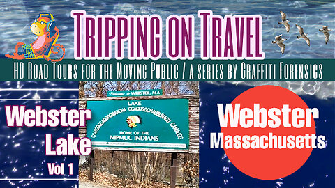
We continue to tour, in volume 2 of this series, what I call the Point Breeze Rd peninsula on Webster Lake. Here, we drive from the end of Loveland Rd to the end of South Point Rd. People familiar with real estate in New England know how expensive it can be to buy waterfront property. And as one can see from some of the properties I drive by, there are some rather nice homes on Webster Lake. As there are with many lakeside properties in New England. But what's wrong with an affluent neighborhood? Nothing. What's wrong with a mixed community of exquisite homes and more modest ones? Nothing. Everything I've seen on Webster Lake is clean, attractive and well cared for. There is no blight. It's the people living and visiting there that make a difference in keeping the lake's environment clean, attractive, civil and well-worth the value of some of the properties. There is nothing unusual about the origin of Webster, Massachusetts in the context of New England's history. As Wikipedia puts it, Webster was the ancestral home of the Nipmuc indians for thousands of years. "It was first settled by Europeans in 1713 and was officially incorporated on March 6, 1832." Also not unusual, is that the town sprouted from the textile industry. "The primary founder was the manufacturer Samuel Slater, who came to the area after his celebrated activities in Pawtucket, Rhode Island, and founded several textile mills. He named the town after his friend Daniel Webster. Slater spent his last years in Webster and died and is buried there in Mount Zion Cemetery." Webster Lake itself is "a 1,442-acre lake with a 17-mile shoreline in southern Massachusetts ..... It is the third largest fresh body of water in Massachusetts."
References:
Wikipedia, Lake Chaubunagungamaug
https://en.wikipedia.org/wiki/Lake_Chaubunagungamaug
Wikipedia, Chaubunagungamaug_Reservation
https://en.wikipedia.org/wiki/Chaubunagungamaug_Reservation
Be Chillin’ by Alexander Nakarada | https://www.serpentsoundstudios.com
Music promoted by https://www.free-stock-music.com
Attribution 4.0 International (CC BY 4.0)
https://creativecommons.org/licenses/by/4.0/
Maps of routes by Bing Maps. My only task was to trace my driving route from A (start) to B (end) to match the footage that follows it.
Other Graffiti Forensics channels and pages
http://www.youtube.com/c/GraffitiForensics
https://www.facebook.com/GForensics/
https://www.bitchute.com/channel/graffitiforensics
12
views
Tripping on Travel: Webster Lake, Webster, Massachusetts
One of the declarations made by some early European, Christian settlers in New England, was that they were on a mission to preach the holy scriptures to the people of the "New World". The people they were referring to included native, North American indian tribes. And there were several identified in the historic record of New England. One of which, was the Nipmucs. As my footage of my travels on April 11, 2023 begins in volume one of this series regarding Webster, Massachusetts, I cross the Massachusetts border from Connecticut as I travel north on Rt 193. One can see the Welcome to Massachusetts and Webster town line signs as I pass them. Until one comes upon the larger green sign titled with the long version of the original name for the lake and the statement that it's the home of the Nipmucs. From that point, I turn right onto Point Breeze Rd and then drive to the end of Loveland Rd. As I proceed with subsequent volumes of this series, you may come to learn that it WAS the home of the Nipmucs, but is no longer. The historic record tells us the original Nipmuc name of the lake was a shorter "Lake Chaubunagungamaug", as it appeared in the earliest local records. But as time went on and people scrutinized it's meaning, local maps were produced that sometimes showed it with a longer name. As well, as Wikipedia puts it, "Today, 'Webster Lake' may be the name most used, but some (including many residents of Webster) take pride in reeling off the longer version." And why not? "The exaggerated name 'Lake Chargoggagoggmanchauggagoggchaubunagungamaugg' (/ˌleɪk tʃɚˈɡɒɡəɡɒɡ ˌmænˈtʃɔːɡəɡɒɡ tʃəˌbʌnəˈɡʌŋɡəmɔːɡ/) is a 45-letter alternative name for this body of fresh water, often cited as the longest place name in the United States and one of the longest in the world." If you ever catch wind of a Nipmuck reservation nearby the lake, one should know that it's only defined by 2.5 acres of land, and it's not supportive of permanent residency. It's used as a meeting place and cultural center, and also a place for the internment of Native American remains.
References:
Wikipedia, Lake Chaubunagungamaug
https://en.wikipedia.org/wiki/Lake_Chaubunagungamaug
Wikipedia, Chaubunagungamaug_Reservation
https://en.wikipedia.org/wiki/Chaubunagungamaug_Reservation
Astronaut In A Submarine by | e s c p | https://escp-music.bandcamp.com
Music promoted by https://www.free-stock-music.com
Creative Commons / Attribution 4.0 International (CC BY 4.0)
https://creativecommons.org/licenses/by/4.0/
Maps of routes by Bing Maps. My only task was to trace my driving route from A (start) to B (end) to match the footage that follows it.
Other Graffiti Forensics channels and pages
http://www.youtube.com/c/GraffitiForensics
https://www.facebook.com/GForensics/
https://www.bitchute.com/channel/graffitiforensics/
17
views
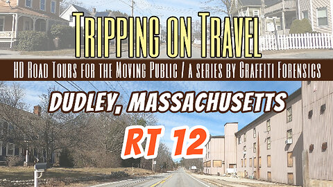
Tripping on Travel: Dudley, Massachusetts
As is the case with many towns in New England, the origin of Dudley, Massachusetts is best reflected in a very old book about it's history. Historian, Joshua Bates, explains in his 1853 book, that "Indeed, the preamble to the Act of the General Court, in- corporating the town, implies, that the petition for the Act, by the first settlers, was founded on a desire to enjoy the privileges of public worship, and maintain the preaching of the gospel to themselves and their families." That's the reality of many of the early European settlers of what is now New England. They sought the freedom to worship God their way. If not for some of the extremism of religious zealotry during those early centuries of European settlers, it would all seem rather benign in hindsight. Bates continues, "It is certainly a dis- couraging fact, that this town is so situated with reference to the places of public worship in the adjoining towns, that several of our good inhabitants, who sympathise with the Congregational church here, and originally acted and worshiped with it, have been induced to change their church relation, and now go out of town to attend public worship." Bates also explains that when first incorporated, in the year 1732, Dudley's area was much larger, including a small part of what is now Southbridge, and a portion of what now constitutes the town of Webster. "The French River received its name from a company of thirty families of Huguenots, who were driven from France by the repeal of the edict of Nantz, and permitted by the proprietors of Oxford, to settle near its banks, where they remained till they were dispersed by the Indians." Oxford is a nearby town. The Huguenots were French Protestants who escaped Catholic persecution in France. Despite what he does know, Bates is not sure about who Dudley was named after. But he is sure it is named after someone in the Dudley family. As for the indians who occupied the land prior to these settlements and colonies, well, all I know is their culture of beliefs, and their presence, is all but completely vanquished from the New England landscape, left with only the reservations they were herded into. Who now occupies the land they use to live on, after centuries of European migration to the New World, and American growth and industry? You know who. And it's not the indians.
Mountain Legend by Keys of Moon | https://soundcloud.com/keysofmoon
Music promoted by https://www.free-stock-music.com
Creative Commons / Attribution 4.0 International (CC BY 4.0)
https://creativecommons.org/licenses/by/4.0/
Historic references:
'An Anniversary Discourse' by Joshua Bates (1853)
https://archive.org/details/anniversarydisco01bate
Maps of routes by Bing Maps. My only task was to trace my driving route from A (start) to B (end) to match the footage that follows it.
Other Graffiti Forensics channels and pages
http://www.youtube.com/c/GraffitiForensics
https://www.facebook.com/GForensics/
https://www.bitchute.com/channel/graffitiforensics/
43
views

Tripping on Travel: Grove St, Putnam, Connecticut
Grove Street in Putnam, Connecticut is one of the many features still left that speaks to the history of the town. And one of Grove Street's primary features is a monument to General Israel Putnam that was erected in a number of Connecticut towns. I drive right by it in this video and it can be found on the right-hand side of the street. The town was named in his honor. But just out of curiosity regarding his roots, I dug a little deeper. He has been celebrated for years as a hero of the French and Indian War and the American Revolution, as well as being the hunter that finally killed a dangerous wolf in Pomfret that was killing local livestock. What is not spoken of is that he was a descendant of the Putnam family that came from England and were among the first puritans who settled in Salem, Massachusetts. In fact, Israel Putnam's family tree leads back to Ann Putnam Jr and her father Thomas Putnam Jr,, both of whom were two of the primary accusers involved in the Salem Witch Trials of 1692-1693. At the time, daughter Ann was only 12 years old when she appeared afflicted and became a primary accuser of a number of people who were suspected of participating in witchcraft. One of Ann's uncles, Joseph Putnam, and his wife Elizabeth Porter, welcomed their son Israel Putnam into the world when he was born in Salem in 1718. At the approximate age of 31 years, Israel Putnam left Salem, Massachusetts and moved in 1749 to farm land he purchased in Pomfret, Connecticut. Other noteworthy details about Israel Putnam were expressed in an early biography that described him as having "his negro" assist him in getting into the wolf's den, but who would not obey his orders. As far as the hostile Indians he sometimes battled, they were considered to be nothing more than "savages" at that time in history.
Zim by Yuey | https://soundcloud.com/yueyonthebeat
Music promoted by https://www.free-stock-music.com
Attribution 4.0 International (CC BY 4.0)
https://creativecommons.org/licenses/by/4.0/
Historical references:
The life and heroic exploits of Israel Putnam .. : Humphreys, David, 1752-1818
https://archive.org/details/lifeheroicexploi00hump/page/n11/mode/2up?view=theater
Salem Witch Trials - Events, Facts & Victims
https://www.history.com/topics/colonial-america/salem-witch-trials
Putnam - Connecticut History | a CTHumanities Project
https://connecticuthistory.org/towns-page/putnam/
Wikipedia - Putnam, Connecticut
https://en.wikipedia.org/wiki/Putnam,_Connecticut
Ann Putnam - Wikipedia
https://en.wikipedia.org/wiki/Ann_Putnam
Putnam family - Wikipedia
https://en.wikipedia.org/wiki/Putnam_family
Maps of routes by Bing Maps. My only task was to trace my driving route from A (start) to B (end) to match the footage that follows it.
Other Graffiti Forensics channels and pages
https://rumble.com/c/c-1218693
http://www.youtube.com/c/GraffitiForensics
https://www.facebook.com/GForensics/
34
views
Tripping on Travel: Scituate, Rhode Island
One may find Rhode Island is full of history if one goes looking for it. Scituate, Rhode Island is the first New England town I've read about to have been settled by "emigrants" from another Scituate. They came from Scituate, Massachusetts, a seacoast town. Wikipedia goes on to explain that in 1915, "the Rhode Island General Assembly voted to take 14,800 acres (60 km2) of land in Scituate (38% of the town) to create a reservoir to supply fresh water to greater Providence." The project, which became the Scituate Reservoir, resulted in the loss of several communities and properties. But Wikipedia doesn't specifically say if this was by Eminent Domain or not. "This project resulted in the condemnation of 1,195 buildings, including 375 houses, seven schools, six churches, six mills, thirty dairy farms, eleven ice houses, post offices, and an electric railway system, the Providence and Danielson Railway system. The hamlets of Kent, Richmond, Rockland, South Scituate, Ashland, Saundersville, Ponaganset and parts of North Scituate and Clayville disappeared forever." Wikipedia goes on to cite it's WW2 history, when a Federal Communications Commission Radio Intelligence Division monitoring facility near Chopmist Hill intercepted German HF communications. "Because of this, in 1946, the Chopmist Hill area was considered as a candidate for the location of the headquarters of the United Nations."
This Too Shall Pass by Scott Buckley | https://soundcloud.com/scottbuckley
Music promoted by https://www.free-stock-music.com
Creative Commons / Attribution 4.0 International (CC BY 4.0)
https://creativecommons.org/licenses/by/4.0/
Maps of routes by Bing Maps. My only task was to trace my driving route from A (start) to B (end) to match the footage that follows it.
Other Graffiti Forensics channels and pages
https://rumble.com/c/c-1218693
http://www.youtube.com/c/GraffitiForensics
https://www.facebook.com/GForensics/
https://www.bitchute.com/channel/graffitiforensics/
29
views

Tripping on Travel: Foster, Rhode Island
If you read the literature published about the history of Foster, Rhode Island as told by the Foster Preservation Society, referencing a document from 1891, you will experience a rather lighthearted tale about the area, full of numbers and statistics, the name of the founders and other political and religious actors involved in it's birth. But if you read a history of Foster as told by Wikipedia in 2023, you learn of a darker side to it's history. Such as, the land was originally occupied and used by a local indian tribe. Such as, British colonists purchased the land called West Quanaug from that indian tribe in 1662 and settled on it. Wikipedia goes on to say that the Klu Klux Klan was active in the area in the 1920s, and "the largest Klan rally north of the Mason–Dixon line was held in Foster on the Old Home Day grounds in 1924 with 8,000 in attendance and U.S. Senator J. Thomas Heflin of Alabama speaking. Foster remained a bastion of racial and religious bigotry for more than half a century." During my route in this video I drive over a hill titled Jerimoth Hill. It suffers from a conflicting notoriety as being the highest point in Rhode Island (812 ft), and yet is still the lowest state highpoint in New England.
Might & Magic by Alexander Nakarada | https://www.serpentsoundstudios.com
Music promoted by https://www.free-stock-music.com
Creative Commons / Attribution 4.0 International (CC BY 4.0)
https://creativecommons.org/licenses/by/4.0/
Foster Preservation Society
https://fosterpreservationsociety.org
Wikipedia & Foster, Rhode Island
https://en.wikipedia.org/wiki/Foster,_Rhode_Island
Maps of routes by Bing Maps. My only task was to trace my driving route from A (start) to B (end) to match the footage that follows it.
Other Graffiti Forensics channels and pages
http://www.youtube.com/c/GraffitiForensics
https://www.facebook.com/GForensics/
https://www.bitchute.com/channel/graffitiforensics/
61
views

Tripping on Travel: Dayville, CT
The village of Dayville, Connecticut will sometimes be referenced as Killingly by some residents because it's within the town of Killingly. Nevertheless, the Killingly Historical and Genealogical Society explains that Dayville has it's roots all the way back to the 1800s. It was named after John Day, who owned and developed the water privilege along what is now the Five Mile River. This became the freight hub for manufacturing sites along the river. John Day built the Sayles Mill in 1846. Dayville would become another example of the many mill towns that were developed adjacent to rivers in northeastern Connecticut. And Killingly, another example of a New England town that was originally occupied by Native Americans, for thousands of years before European settlers moved into Connecticut during the 1600s.
Solecism by Scott Buckley | https://soundcloud.com/scottbuckley
Music promoted by https://www.free-stock-music.com
Creative Commons / Attribution 4.0 International (CC BY 4.0)
https://creativecommons.org/licenses/by/4.0/
Bring Me The Sky by Scott Buckley | https://soundcloud.com/scottbuckley
Music promoted by https://www.free-stock-music.com
Creative Commons / Attribution 4.0 International (CC BY 4.0)
https://creativecommons.org/licenses/by/4.0/
Maps of routes by Bing Maps. My only task was to trace my driving route from A (start) to B (end) to match the footage that follows it.
Other Graffiti Forensics channels and pages
http://www.youtube.com/c/GraffitiForensics
https://www.facebook.com/GForensics/
https://www.bitchute.com/channel/graffitiforensics/
14
views

Tripping on Travel: East Killingly, Connecticut
In this episode, I drive west on Rt 101 from the Rhode Island border and into East Killingly, Connecticut. According to the Killingly Historical and Geneological Society, during the 1830’s, Killingly was the largest producer of cotton goods in Connecticut. In 1653, John Winthrop obtained a grant of a large tract of land formerly held by the Quinebaug Indian tribe and known as the Quinebaug (Long Pond) Country. Following this, the town was settled in 1700, incorporated in 1708, the forty-second town established in Connecticut. The selection of a name for the town was referred to Governor Saltonstall, whose ancestral manorial possessions lay in Killanslie and Pontefract, Yorkshire, hence “Killingly,” formerly spelled Kellingly, was taken from this part of England.
Twilight City by | e s c p | https://escp-music.bandcamp.com
Music promoted by https://www.free-stock-music.com
Attribution 4.0 International (CC BY 4.0)
https://creativecommons.org/licenses/by/4.0/
Maps of routes by Bing Maps. My only task was to trace my driving route from A (start) to B (end) to match the footage that follows it.
Other Graffiti Forensics channels and pages
http://www.youtube.com/c/GraffitiForensics
https://www.facebook.com/GForensics/
https://www.bitchute.com/channel/graffitiforensics/
12
views

RAE: The Gassive-Aggressive Student
In this brief production, a gassy student needs to use the bathroom but fails to get the attention of the professor speaking in the background. I put an adolescent spin into this avatar. The avatar is animated via my facial, body and arm expressions captured by a webcam in front of me. The avatar and professor voice-overs were done by me. One brief segment involved a voice-over expressed by my daughter. It was fun. And there is more to come.
The avatar, scene background and the software are products of Wondershare: https://www.wondershare.com/
Other Graffiti Forensics channels and pages
http://www.youtube.com/c/GraffitiForensics
https://www.facebook.com/GForensics/
https://www.bitchute.com/channel/graffitiforensics/
2
views

Tripping on Travel: MORE East Putnam, Connecticut
The origin of the town's name is explained in this paragraph published by the ConnecticutHistory website; "Israel Putnam is a name that stands out in the colonial history of Connecticut as a war hero of the French and Indian War and the American Revolution. Prior to his wartime glory, he earned the nickname 'Wolf Putnam' by killing what was believed to be the last wolf in Connecticut when he was a young farmer in the eastern Connecticut town of Pomfret."
Sail Away by | e s c p | https://escp-music.bandcamp.com
Music promoted by https://www.free-stock-music.com
Attribution 4.0 International (CC BY 4.0)
https://creativecommons.org/licenses/by/4.0/Music
The story of Israel Putnam
https://connecticuthistory.org/the-last-wolf-in-connecticut/
Maps of routes by Bing Maps. My only task was to trace my driving route from A (start) to B (end) to match the footage that follows it.
Other Graffiti Forensics channels and pages
http://www.youtube.com/c/GraffitiForensics
https://www.facebook.com/GForensics/
https://www.bitchute.com/channel/graffitiforensics/
5
views
Tripping on Travel: East Putnam, Connecticut
As Wikipedia explains it, the Five Mile River is actually 23.5 miles long and is located in Connecticut's Northeast Corner and flows through the towns of Thompson, Putnam, and Killingly. It's original name leads us back to the Nipmuc indians, who called it Assawaga, meaning "place between" or "halfway place". Five Mile River has several dams related mostly to former mill operations and the harnessing of waterpower for industry.
Maleficus by Scott Buckley | https://soundcloud.com/scottbuckley
Music promoted by https://www.free-stock-music.com
Creative Commons / Attribution 4.0 International (CC BY 4.0)
https://creativecommons.org/licenses/by/4.0/
Maps of routes by Bing Maps. My only task was to trace my driving route from A (start) to B (end) to match the footage that follows it.
Other Graffiti Forensics channels and pages
http://www.youtube.com/c/GraffitiForensics
https://www.facebook.com/GForensics/
https://www.bitchute.com/channel/graffitiforensics/
6
views