

Solar Eclipse: Measuring Lux and Listening on Doppler Radar (Nevada 2023)
Aura 14 Day Free Trial: https://aura.com/ufoseekers | Protect your family from identity theft, fraud, and online threats with Aura. Use the link above for a 14 day free trial and 63% Off! (Offer subject to change.)
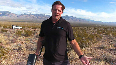
Our team measured the Lux (Illumination) of the 2023 Annular Eclipse in Southern Nevada (Pahrump) on October 14 at 9:20-9:21am. We also listened via a Doppler Radar pointed directly at the sun during the annular eclipse.
Our minimum lux meter reading was 6,302 Lux. Our normal Lux for that time of day is approx. 8,000 Lux (with partial cloud cover approximated). Our meter measured a 21% + - decline in the sun's illumination during the annular eclipse. We also captured anomalies on the Doppler Radar although they may be bugs or birds.
An Annular Eclipse varies from a Total Eclipse in one major way. While a Total Solar Eclipse obscures the entirety of the sun at its peak totality, an Annular Solar Eclipse means that a small amount of annularity, popularly known as a "Ring of Fire," remains. These differences occur due to the moon's elliptical orbit around the Earth, so the distance is not constant and allows the moon to appear smaller or larger in the sky. Annular eclipses take place during a further part of the moon's orbit.
The lux (symbol: lx) is the unit of illuminance, or luminous flux per unit area, in the International System of Units (SI). It is equal to one lumen per square metre. In photometry, this is used as a measure of the intensity, as perceived by the human eye, of light that hits or passes through a surface. It is analogous to the radiometric unit watt per square metre, but with the power at each wavelength weighted according to the luminosity function, a model of human visual brightness perception, standardized by the CIE and ISO.
394
views
1
comment
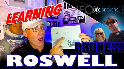
1947 Roswell “UFO" Crash Research: 1946 Drone Technology & Nuclear Testing
Aura 14 Day Free Trial: https://aura.com/ufoseekers
Protect your family from identity theft, fraud, and online threats with Aura. Use the link above for a 14 day free trial and 63% Off! (Offer subject to change.)
Our team of UFO & Alien Investigators©, show you unmanned aerial vehicles (drones) flying at New Mexico's Roswell Army Airfield in 1946. The drones were to be used for "Operation Crossroads" which were atomic tests that occurred at the Bikini Atoll islands in the Pacific. The aircraft for the atomic tests took off from Roswell Army Airfield. We also show you the GAPA missile (ground-to-air-pilotless aircraft), Colonel Ulysses S. Nero (father of precision bombing), and General Roger Ramey (famous man seen in the Roswell debris images) at Roswell Army Airfield as he participated in drone tests at Roswell Army Airfield.
Col. Ulysses S. (Sam) Nero (1898-1980): https://www.dahf.org/UNero.html
Operation Crossroads: https://en.wikipedia.org/wiki/Operation_Crossroads
Dave's Dream B-29 Superfortress: https://en.wikipedia.org/wiki/Big_Stink_(aircraft)
249
views
2
comments
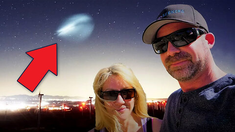
Object Captured Over California After SpaceX's Epic Starman Launch from Florida in 2018!
While sky watching for UFO activity on a windmill farm above the Mojave Desert of California, our team spotted something glowing in the sky moving from north to south. Our location was Mojave, California in the desert north of Los Angeles. Earlier that day, SpaceX launched Starman (Falcon Heavy rocket carrying a Tesla Roadster once driven by Elon Musk) from Florida. But what we captured occurred after that, in California, at night.
02/06/2018 7:30 PM PST
711
views
6
comments
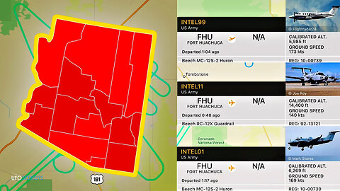
Arizona Intelligence Soldiers and Domestic Spy Aircraft in California
Our team introduces you to US Army intelligence soldiers. We also cover the use of domestic spy aircraft from the National Guard in California to spy on civilian protestors. Our team captured intelligence aircraft from Fort Huachuca flying over Arizona on flight radar of which we provide screenshots and FAA reg numbers. We also appear to have captured one of these helicopters over California.
Fort Huachuca is a United States Army installation, established on 3 March 1877 as Camp Huachuca. The garrison is now under the command of the United States Army Installation Management Command.
National Guard Aircraft Used During George Floyd Protests for Intelligence Gathering: https://taskandpurpose.com/news/california-national-guard-george-floyd-protests/
Inspector General Report on National Guard Using Intelligence Assets to Spy on George Floyd Protestors: https://www.airforcemag.com/air-force-ig-rc-26s-didnt-collect-protestors-info-but-mistakes-were-made/
US Military videos by Sgt. 1st Class Kristine Smedley, Sgt. Carolyn Ennis, SSG Heidi McClintock, and 3rd Brigade, 3rd Infantry Division Public Affairs Office. The use of military footage does not constitute an endorsement by the US Military.
313
views
3
comments
Unveiling What's Hidden Within New Mexico's White Sands Missile Range!
Underground entrances, the Space Surveillance Telescope, the Aerial Cable Range, NASA, Holloman Air Force Base, the Trinity Site, Spaceport America, and more all reside within the perimeter of White Sands Missile Range in New Mexico. In this video, our team takes you on a Google Earth tour of the facility to show you interesting locations throughout the sprawling range. Let's see what's out there!
753
views
1
comment
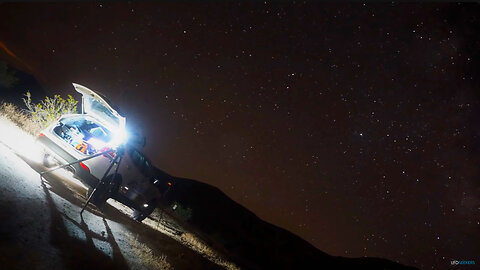
Sky-Watching at Red Mountain in California's Mojave Desert
Our team goes sky-watching for UFO activity at Red Mountain in California's Mojave Desert. Using infrared night vision and other equipment our team will watch the sky in hopes of spotting anomalies. On this night, the Milky Way was ablaze, and shooting stars were everywhere. Let's see what's out there. Red Mountain is an old volcanic peak near the towns of Johannesburg and Randsburg off of the 395 in the northern Mojave Desert of California.
232
views
2
comments
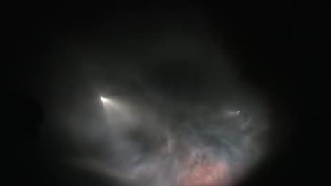
Incredible Rocket Plume & Expansion Waves Filmed Over California
Watch an amazing rocket plume and expansion waves created by a SpaceX Falcon 9 Launch we filmed on 10/07/2018 from Lockwood Valley, California. This is an uncut version of the complete sequence from start to finish. The launch took place from Vandenberg Air Force Base near Santa Maria, California.
In this uncut video sequence, the rocket to space and the reusable booster both create plumes. The booster also creates incredible expansion waves. The reusable booster can be seen shortly during its return to the launchpad.
What is a plume and what are expansion waves?
"...the nozzle must expand the high-pressure combusted fuel to a low-pressure exhaust at its exit plane – the maximum thrust is reached when the nozzle expands the combustion gases to the same pressure as the atmosphere outside the nozzle. Since the pressure in the atmosphere decreases dramatically for most of the launch the pressure at the nozzle exit is either higher or lower than the atmospheric pressure.Since the pressure in the atmosphere decreases dramatically for most of the launch the pressure at the nozzle exit is either higher or lower than the atmospheric pressure. This leads to an interesting phenomenon in the nozzle exit region plume. Since the plume is traveling at supersonic speeds relative to the external atmosphere the pressure difference produces shockwaves and expansion waves which in turn form areas of afterburning combustion in the plume." - http://blogs.esa.int/cleanspace/2016/03/01/what-happens-in-a-rocket-plume/
The camera is facing west and the rocket is heading south towards Mexico over the Pacific Ocean.
Rocket Launch plumes are very popular on the internet and television for use as evidence of alien UFOs visiting Earth. Especially television. Rocket plumes are common occurrences throughout the world, as many countries now send objects into space.
The purpose of this video is to provide UFO Investigators with a video reference, filmed first-hand by a UFO Investigator, to help dispel or reinforce conclusions about objects reported by witnesses or seen in "UFO" videos.
Destination Unknown by Audionautix is licensed under a Creative Commons Attribution license (https://creativecommons.org/licenses/by/4.0/)
Artist: http://audionautix.com/
Darkness Speaks by Kevin MacLeod is licensed under a Creative Commons Attribution license (https://creativecommons.org/licenses/by/4.0/)
Source: http://incompetech.com/music/royalty-free/index.html?isrc=USUAN1100364
Artist: http://incompetech.com/
Deep Space by Audionautix is licensed under a Creative Commons Attribution license (https://creativecommons.org/licenses/by/4.0/)
Artist: http://audionautix.com/
334
views
1
comment
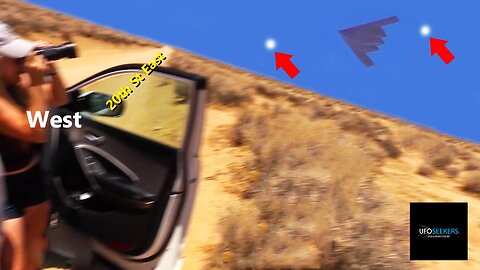
UFO Sighting in B-2 Stealth Bomber Photographs from California's Mojave Desert
Our investigator, Tracey, captured this white object in Stealth Bomber photographs while sky-watching in Mojave, California on May 24, 2021. The B-2 Stealth Bomber was flying out of Edwards Air Force Base in California's Mojave Desert heading northwest into the Sierra Nevada Mountains.
The Northrop Grumman B-2 Spirit, also known as the Stealth Bomber, is an American heavy strategic bomber, featuring low-observable stealth technology designed to penetrate dense anti-aircraft defenses. A subsonic flying wing with a crew of two, the plane was designed by Northrop (later Northrop Grumman) and produced from 1987 to 2000.
Edwards Air Force Base is a United States Air Force installation in California. Most of the base sits in Kern County, but its eastern end is in San Bernardino County and a southern arm is in Los Angeles County. The hub of the base is Edwards, California.
327
views
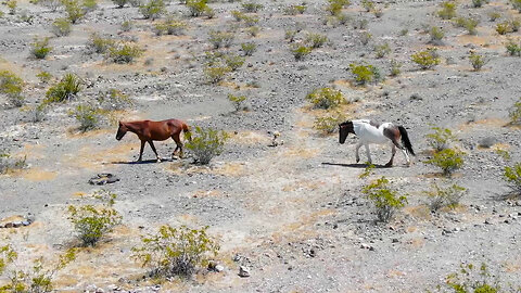
Following Wild Horses Roaming Free in Pahrump, Nevada
Wild horses are still roaming in Nevada and we captured these 3 walking through Pahrump, Nevada headed north. Staying at a distance that doesn't affect or attract attention from the horses, we observed their movements as they moved through our small town. Observations were performed via UAS.
266
views
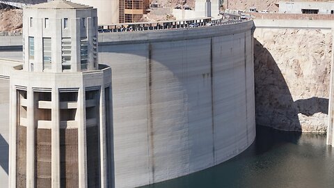
Quick Look at Hoover Dam & Lake Mead's Current Water Level (Nevada/Arizona Border)
Our team wanted to see the current state of Lake Mead, the water level, and view the Hoover Dam (both in Nevada / Arizona). The location is roughly 1 hour from our HQ in Pahrump, Nevada. Maybe we will sky-watch at the location as we were scouting for areas or how we would put together such an episode.
The current water level is 1066 feet (when we made the film, now at 1067 feet). The dam stops generating hydroelectric power at 1050 feet. The lake was below that level earlier this year (2023) according to the stats we looked at.
When entering the Hoover Dam area, you can not have firearms, controlled substances, or drones. DO NOT BRING A DRONE. All vehicles entering the area are subject to search. K-9 units are on-location. The area is very safe and secure.
928
views
1
comment
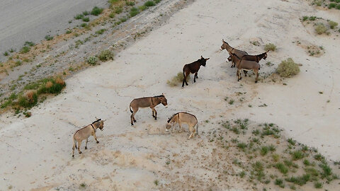
Following a Herd of Wild Donkeys in Pahrump, Nevada
Fly with us as we watch a herd of wild donkeys roaming through our small rural town of Pahrump, Nevada. Using a UAS we were able to stay far away, never affecting any of the wild donkeys, and observe their movement through a section of town. Our town + residents love these wild donkeys. We wish they forever roam free in Nevada!
412
views
2
comments
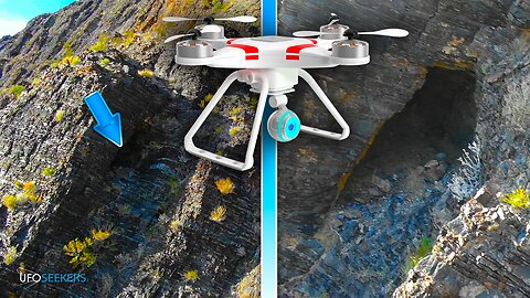
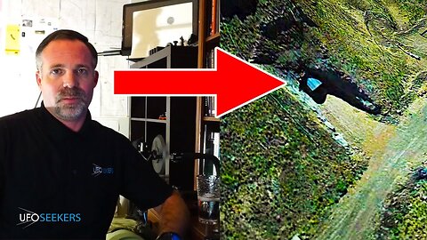
Discovering 2 Hidden High-Elevation Openings on Last Change Range in Pahrump, Nevada
Our team discovered these two hidden openings high up on the east face of Last Chance Range in Pahrump, Nevada. The east face is expansive and this is just one section in rural southern Nevada. Our exploration is performed via UAS. The Last Chance Range is a mountain range in Nye County, Nevada. It lies immediately north of Pahrump, Nevada, and west of Nevada State Route 160.
205
views
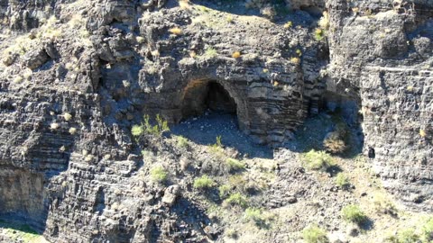
Looking for Hidden Openings in Nevada's Last Chance Range
We're searching for hidden openings in Nevada's Last Chance Range. Join us as we explore the mountain range via drone for evidence of anything with large openings. This exploration is performed via UAS. Last Chance Range is located in Pahrump, Nevada, west of Las Vegas and near the border of California. Let's see what's out there!
357
views
2
comments
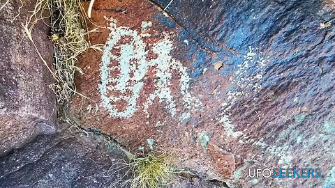
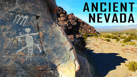
We Discovered This “Portal” Petroglyph and Ancient Fire Ring in Johnnie, Nevada
We discovered a petroglyph, which looks like a portal outside of a cave entrance in Johnnie, Nevada. at the same location. We also discovered a fire ring. Join us as we document the entire location having just been there in November. These petroglyphs range in age from hundreds of years 2000s of years old and were created by Native Americans here in Nevada.
176
views
1
comment
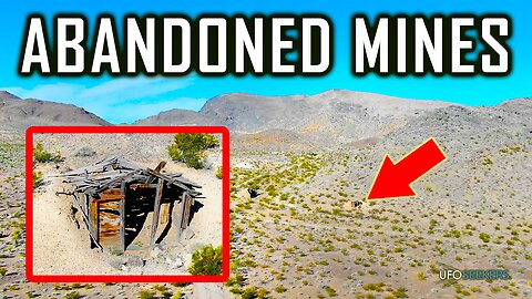
Flying Over Abandoned Mines in Johnnie, Nevada
Scattered throughout the landscape of Johnnie, Nevada are many abandoned mines. While flying today (10/27/2023) we looked at a few of them, attempting to take a peek into the mine shafts or remnants of what used to be a mine. What secrets lay hidden inside these abandoned mines? Come seek with us. Let's see what's out there!
299
views
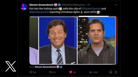
Tucker Carlson + ex-FBI Agent = UFOs Over Wisconsin
All of us can become blinded to the truth when information originates from very famous pop culture icons. In this video, we take a look at a news media journalist, Tucker Carlson, who as a host on Fox News appears to tell Americans a Christmas Light show at a family's house was actually alien spaceships over Wisconsin. Tucker was also joined by Ben Hansen, an ex-FBI agent and Hollywood UFO Celebrity who appears to parrot the same claims, that Christmas Lights are even similar to "Foo Fighters" from World War 2.
Luckily for all of us, a journalist for the New York Post, Steven Greenstreet, created this video. His video is posted to X via his X account.
Follow Steven Greenstreet: https://twitter.com/MiddleOfMayhem
Steven's Post on X: https://twitter.com/MiddleOfMayhem/status/1736424473606443177
550
views
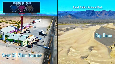
Flying Over the Area 51 Alien Center and Big Dune in Amargosa Valley, Nevada
Located in Southern Nevada is the Area 51 Alien Center. Our team takes you on a flight over the area which is highly visited by tourists visiting Nevada and Area 51.
After flying over the Area 51 Alien Travel Center our team will take you to "Big Dune" located close to the travel center, both in Amargosa Valley. The dunes at "Big Dune" in Nevada are located along the border of Death Valley National Park. The Big Dunes cover five square miles and tower about 500’. Big Dune is home to sensitive plants and animals.
173
views

Travis Walton's Alien Abduction from Fire in the Sky - Things That Go Pahrump In The Night © | Ep. 8
Join our host Tim Doyle, Lead Investigator of UFO & Alien Investigaotors®, as he dives into the UFO topic. Our host covers the Travis Walton alien abduction with complete details of the incident, experience, police activity, polygraph examinations, UFO community response, Dr J Allen Hynek's response, and so much more. Was the movie, Fire in the Sky, accurate? Did Travis really disappear? The incident took place on November 5, 1975, roughly 10+ miles from Heber, Arizona.
181
views
1
comment
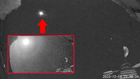
We Just Captured a MASSIVE METEOR Over The Nuclear Test Site! (12/142023 23:48:20 PM)
Our live cam just captured this massive meteor falling over the nuclear test site in Nevada. The time stamp can be seen. 12/14/2023 23:4820 PM PST (11:49). The camera is facing north (also left hand side of screen). Right is straight up. Right is east.
100% Real. No Actors. No Setup Scenarios. Join our team of UFO & Alien Investigators© (Tim & Tracey) as we sky-watch from our headquarters in Pahrump, Nevada for UFO Sighting activity. Thanks for watching. Let's see what's out there!
The UFO Seekers name & logo are a registered trademark (servicemark) in the USA. Any commercial usage of the UFO Seekers® name or logo is strictly forbidden without expressed written permission from an authorized representative of UFO Seekers®. USPTO Serial # 90126027 DBA: "UFO Seekers"
369
views
2
comments
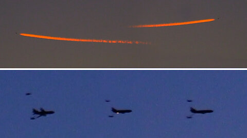
We Watched Sunset F-35 Practice over Death Valley National Park Yesterday
A quick look at F-35 practice yesterday over Death Valley National Park in California. We captured 4 aircraft in total, 1 refueler and 3 F-35s while sky watching. The aircraft were creating awesome-looking contrails in the sunset.
100% Real. No Actors. No Setup Scenarios. Join our team of UFO & Alien Investigators© (Tim & Tracey) as we sky-watch from our headquarters in Pahrump, Nevada for UFO Sighting activity. Thanks for watching. Let's see what's out there!
131
views
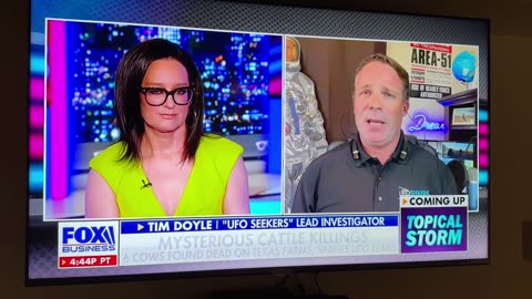
We Discuss Mysterious Cattle Mutilations on Fox Business with Kennedy
Our Lead Investigator, Tim Doyle, appears on Kennedy to discuss the recent cattle mutilations that occurred in Madison County, Texas. Topics discussed include the Texas Cattle Mutilations, Linda Moulton Howe evidence (Tex Graves testimony given to Congress), Roswell, Fort Worth, Gabe Valdez, Dulce Base, 1957 Sheriff Weir & Texas Tech student UFO (Levelland), and Brian Morris of AAAC Wildlife Removal.
263
views
We Used a Metal Detector in the Rural Nevada Desert and Found?...
Join us as we go metal detecting in the rural southern Nevada desert just north of Pahrump. Our team went looking for anything in the dirt with the detector on for, "all metal." We tried to choose an area without much impact from humans, away from dirt roads or mining activity. We spent hours scouring the Nevada desert with a metal detector. What will we find? Will trash be everywhere? Will we find nothing? Let's see what's out there!
"A metal detector is an instrument that detects the nearby presence of metal. Metal detectors are useful for finding metal objects on the surface, underground, and underwater. The unit itself consists of a control box, and an adjustable shaft, which holds a pickup coil, which can vary in shape and size. If the pickup coil comes near a piece of metal, the control box will register its presence by a changing tone, a flashing light, and or by a needle moving on an indicator. Usually, the device gives some indication of distance; the closer the metal is, the higher the tone in the earphone or the higher the needle goes." - Wikipedia
516
views
1
comment
Flying Over Ancient Petroglyphs Created Thousands of Years Ago in Johnnie, Nevada
We take you flying over ancient petroglyphs in Johnnie, Nevada. The petroglyphs were created by Native Americans during different time frames, but some appear to date back thousands of years. The area is in the northwestern foothills of the Spring Mountains along the edge of Amargosa Valley. Our team takes you above the petroglyphs via drone (UAS).
270
views
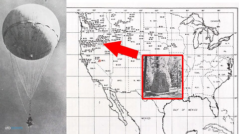
Japanese Balloon Bombs, USA "Office of Censorship", Crash Sites on American Soil
"One of the best kept secrets of the war involved the Japanese balloon bomb offensive. Prompted by the Doolittle Raid on Tokyo in April 1942, the Japanese developed the balloon bombs as a means of direct reprisal against the U.S. mainland. The balloons, made of paper or rubberized silk, carried anti-personnel and incendiary bombs.
The first operational launches took place on Nov. 3, 1944, and two days later a U.S. Navy patrol boat spotted a balloon floating on the water off the coast of California. Japan launched some 9,000 balloons during a five-month period, to be carried by high altitude winds more than 6,000 miles eastward across the Pacific to North America. Perhaps a thousand of these reached this continent, but there were only about 285 reported incidents. Most were reported in the northwest United States, but some balloons traveled as far east as Michigan.
As more sightings occurred, the government, with the cooperation of the news media, adopted a policy of silence to reduce the chance of panic among U.S. residents and to deny the Japanese any information on the success of the launches. Discouraged by the apparent failure of their effort, the Japanese halted their balloon attacks in April 1945.
On May 5, 1945, six picnickers were killed in Oregon when a balloon bomb they dragged from the woods exploded. The U.S. government quickly publicized the balloon bombs, warning people not to tamper with them. These were the only known fatalities occurring within the United States during World War II as a direct result of enemy action.
Actual damage caused by the balloon bombs was minor. However, the incendiaries that these balloons carried did pose a serious threat to the northwestern U.S. forests during dry months. These balloons also offered a vehicle for germ warfare if the Japanese had decided to employ this weapon.
The balloon attacks began after air defense facilities in the United States had been deactivated. To counter this threat, U.S. Army Air Forces and Navy fighters flew intercept missions to shoot down balloons when sighted. Army personnel and USAAF aircraft were also stationed at critical points to combat any forest fires that might occur. In addition, supplies of decontamination chemicals and sprays to counter any possible use of germ warfare were quietly distributed in the western United States. Before detailed USAAF defensive plans had been put into effect, the attacks ceased." - National Museum of the US Air Force
202
views
2
comments

Where Did Grey Aliens Come From? - Things That Go Pahrump In The Night © | Ep. 2
Tonight we discuss extraterrestrial Grey Aliens. Where did they come from? Why do they come to Earth? For what purpose? Let's dive in!
Tonight's topic is part of a theory proposed by Nigel Kerner in the book, "Grey Aliens and the Harvesting of Souls."
Link: https://www.amazon.com/Grey-Aliens-Harvesting-Souls-Genetically/dp/1591431034/ref=sr_1_1?crid=12YXWAMWLUI4C&keywords=great+aliens+and+the+harvesting&qid=1683784856&sprefix=grey+aliens+and+the+harvest%2Caps%2C1066&sr=8-1
Welcome to our Podcast, "Things That Go Pahrump In The Night©" by UFO Seekers®. Broadcasting from Pahrump, Nevada our show is hosted by Tim Doyle, Lead Investigator of UFO Seekers®.
The UFO Seekers name & logo are a registered trademark (servicemark) in the USA. Any commercial usage of the UFO Seekers® name or logo is strictly forbidden without expressed written permission from an authorized representative of UFO Seekers®. USPTO Serial # 90126027 DBA: "UFO Seekers"
#ufoseekers #seekers #ufo
202
views