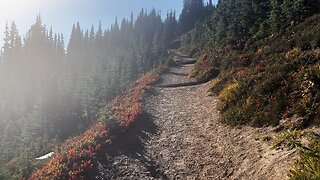
Mt Rainier - Pinnacle Peak Hike October 1, 2021
Trailhead was at the Reflection Lakes viewing area!
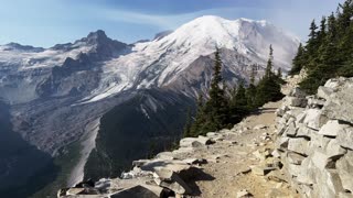
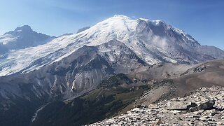
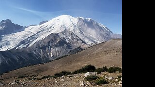
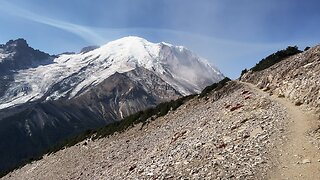
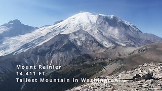
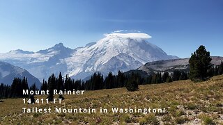
Mount Rainier is a large active stratovolcano in the Cascade Range of the Pacific Northwest. The mountain is located in Mount Rainier National Park about 59 miles (95 km) south-southeast of Seattle. With a summit elevation of 14,411 ft (4,392 m), it is the highest mountain in the U.S. state of Washington and the Cascade Range, the most topographically prominent mountain in the contiguous United States, and the tallest in the Cascade Volcanic Arc.
Due to its high probability of eruption in the near future, Mount Rainier is considered one of the most dangerous volcanoes in the world (Bull crap scare tactic), and it is on the Decade Volcano list. The large amount of glacial ice means that Mount Rainier could produce massive lahars that “could” threaten the entire Puyallup River valley.
Between 1950 and 2018, 439,460 people climbed Mount Rainier.
The Wonderland Trail is an approximately 93-mile (150 km) hiking trail that circumnavigates Mount Rainier in Mount Rainier National Park, Washington, United States. The trail offers spectacular unique views on a daily basis and goes over many ridges of Mount Rainier for a cumulative 22,000 feet (6,700 m) of elevation gain. The trail was built in 1915. In 1981, it was designated a National Recreation Trail. An estimated 200 to 250 people a year complete the entire trail with several thousand others doing shorter sections of it. The average time taken to complete the entire trip is 10 to 14 days.
Longmire
Sunrise
Mowich Lake
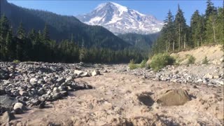
White River
Summerland
Indian Bar
Nickle Creek
Reflection Lakes
Indian Henry’s
Emerald Ridge
South Puyallup
Spray Park
Grand Park
Devil’s Dream
Windy Gap
Northern Loop
Mowich River
Golden Lakes
Kautz
South Tahoma-Tahoma
Puyallup
North Mowich
Summit
Carbon
Winthrop
-
 2:14
2:14
Hiking Videos and Slideshows
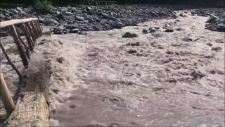
1 year agoMount Rainier - Raging White River (Wonderland Trail 2018)
12 -
 1:00
1:00
Hiking Videos and Slideshows
1 year agoMount Rainier - Raging Nisqually River (Wonderland Trail 2018)
24 -
 1:20
1:20
HikingViking
8 months agoHIKING THE EPIC Burroughs Mountain Trail with SPECTACULAR VIEWS of Mount Rainier National Park! | 4K
923 -
 0:32
0:32
HikingViking
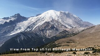
8 months agoALPINE VIEW FROM THE TOP of 1st Burroughs Mountain @ Mount Rainier National Park! | 4K | Washington
474 -
 0:27
0:27
HikingViking
8 months agoALPINE VIEW FROM THE TOP of 2nd Burroughs Mountain @ Mount Rainier National Park! | 4K | Washington
453 -
 3:34
3:34
HikingViking
8 months agoHiking Burroughs Mountain Trail to Glacier Overlook & HANGING WITH MARMOTS! | Mount Rainier | 4K
852 -
 0:40
0:40
HikingViking
6 months agoSide View of INCREDIBLE MOUNT RAINIER While Ascending Burroughs Mountain Trail! | Washington | 4K
1192 -
 0:48
0:48
HikingViking
8 months agoEPIC Burroughs Mountain Trail with INCREDIBLE PERSPECTIVES of Mount Rainier & White River! | 4K
111 -
 12:39
12:39
HikingViking
8 months agoGlacier Overlook to 1st & 2nd Burroughs Mountains to Sourdough! | Mount Rainier National Park | 4K
68 -
 1:33
1:33
HikingViking
7 months agoHighlights of Sourdough Ridge Overlooking Yakima Park Returning to Sunrise Zone | Mount Rainier | 4K
232