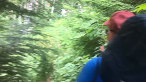
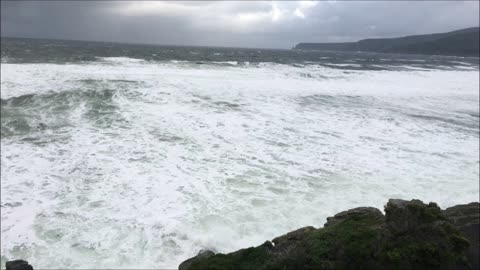
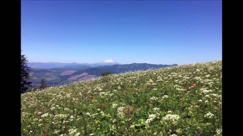
Badlands - Medicine Root Loop Trail
August 3, 2022
Rolling Stones - Wild Horses
Located in southwestern South Dakota, Badlands National Park consists of 244,000 acres of sharply eroded buttes, pinnacles and spires blended with the largest protected mixed grass prairie in the United States. It is desolation at its truest, where you can look for miles and see no sign of civilization.
This land has been so ruthlessly ravaged by wind and water that it has become picturesque. The Badlands are a wonderland of bizarre, colorful spires and pinnacles, massive buttes and deep gorges. Erosion of the Badlands reveals sedimentary layers of different colors: purple and yellow (shale), tan and gray (sand and gravel), red and orange (iron oxides) and white (volcanic ash).
Badlands National Park also preserves the world’s greatest fossil beds of animals from the Oligocene Epoch of the Age of Mammals. The skeletons of ancient camels, three-toed horses, saber-toothed cats and giant rhinoceros-like creatures are among the many fossilized species found here. All fossils, rocks, plants and animals are protected and must remain where you find them. Prehistoric bones are still being uncovered today by park officials.
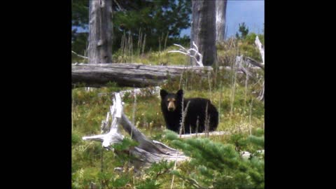
Come enjoy this park’s biological diversity. The Badlands are home to the largest mixed grass prairie in the National Park System and is surrounded by the Buffalo Gap National Grassland. Wildlife roams the park's boundaries as well. Bison, pronghorn, mule and whitetail deer, prairie dogs, coyotes, butterflies, turtles, snakes, bluebirds, vultures, eagles and hawks are just some of the wildlife that can often be seen by visitors. In 1994, the near-extinct Black-footed ferrets were reintroduced into the Badlands prairie. These nocturnal animals are rarely seen by the visiting public.
Mid-summer around the Black Hills is warm and dry with plenty of sunshine. Rapid City sees an average of 20 clear to partly cloudy days and 75 percent of its possible sunshine in June. Humidity levels are low, and there is usually a breeze during the day, so even the hottest days are still comfortable. Early mornings are cool, so a jacket or sweater may be needed for outdoor activities. At night temps drop quite a bit as can be seen in the greater difference between the avg. high and low.
Shorts
Hiking shirt Sleeveless
1 wool or polyester sweater
garbage bags
straps
extra stuff sacks
space blanket
Bowl
spoon
Cup & Plate
Jumper Cables
Elevation
Altitude
Valley
Forest
Knife
Moleskin
Tennis Ball
Rain Gear
Stuff sack
Rain Jacket
Rain Pants
Pack cover
tent sleep items
Pillow
Pair of socks
Hat
Gloves
Long Johns
Long sleeve shirt
extra underwear
camelback
Water Filter purifying tablets
Powder Gatorade
Vitamins
Towel
Toothbrush
Toothpaste
Chap stick
Soap
Bugs
sunscreen
Headlamp
Whistle
Sunglasses
Lighter
Matches
Supplies
Pack
Tent
Sleeping Bag
Sleeping Pad
Boots or Hiking Tennis shoes
Sit Pad
Hiking stick
Map
Sandals
All The Food
Water bottle
Glaciers
Rivers
Mountains
Dust
Dirt
Trail
Track
Hike
Backpack
Overnight
Rope Food
613
views
2
comments
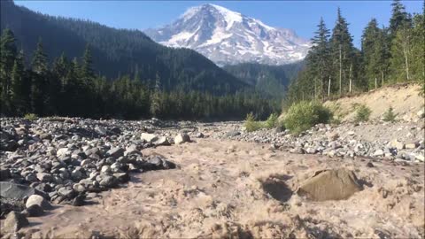
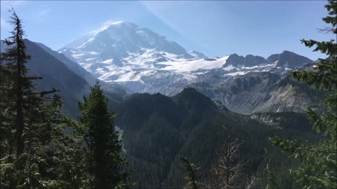
Mount Rainier - Raging White River (Wonderland Trail 2018)
Video shot on Wednesday August 8, 2018
You can hear the boulders rolling along under the water.
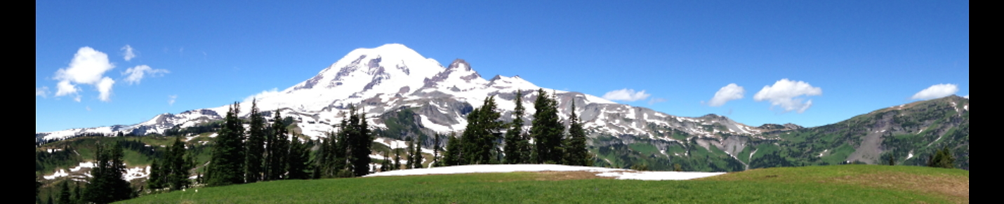
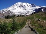
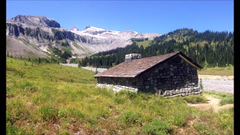
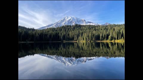
Mount Rainier is a large active stratovolcano in the Cascade Range of the Pacific Northwest. The mountain is located in Mount Rainier National Park about 59 miles (95 km) south-southeast of Seattle. With a summit elevation of 14,411 ft (4,392 m), it is the highest mountain in the U.S. state of Washington and the Cascade Range, the most topographically prominent mountain in the contiguous United States, and the tallest in the Cascade Volcanic Arc.
Due to its high probability of eruption in the near future, Mount Rainier is considered one of the most dangerous volcanoes in the world (Bull crap scare tactic), and it is on the Decade Volcano list. The large amount of glacial ice means that Mount Rainier could produce massive lahars that “could” threaten the entire Puyallup River valley.
Between 1950 and 2018, 439,460 people climbed Mount Rainier.
The Wonderland Trail is an approximately 93-mile (150 km) hiking trail that circumnavigates Mount Rainier in Mount Rainier National Park, Washington, United States. The trail offers spectacular unique views on a daily basis and goes over many ridges of Mount Rainier for a cumulative 22,000 feet (6,700 m) of elevation gain. The trail was built in 1915. In 1981, it was designated a National Recreation Trail. An estimated 200 to 250 people a year complete the entire trail with several thousand others doing shorter sections of it. The average time taken to complete the entire trip is 10 to 14 days.
Longmire
Sunrise
Mowich Lake
White River
Summerland
Indian Bar
Nickle Creek
Reflection Lakes
Indian Henry’s
Emerald Ridge
South Puyallup
Spray Park
Grand Park
Devil’s Dream
Windy Gap
Northern Loop
Mowich River
Golden Lakes
Kautz
South Tahoma-Tahoma
Puyallup
North Mowich
Summit
Carbon
Winthrop
Unfortunately Mount Rainier was obscured by smoke from the many fires burning in Washington State at the time.
12
views
Mount Rainier - Raging Nisqually River (Wonderland Trail 2018)
Video Shot on Friday August 10, 2018
while the Nisqually Glacier was in full melt mode during a hot summer day. The Nisqually glacier is one of the larger glaciers on the southwestern face of Mount Rainier. The glacier is one of the most easily viewed on the mountain, and is accessible from the Paradise visitor area at Mount Rainier National Park.
Mount Rainier is a large active stratovolcano in the Cascade Range of the Pacific Northwest. The mountain is located in Mount Rainier National Park about 59 miles (95 km) south-southeast of Seattle. With a summit elevation of 14,411 ft (4,392 m), it is the highest mountain in the U.S. state of Washington and the Cascade Range, the most topographically prominent mountain in the contiguous United States, and the tallest in the Cascade Volcanic Arc.
Due to its high probability of eruption in the near future, Mount Rainier is considered one of the most dangerous volcanoes in the world (Bull crap scare tactic), and it is on the Decade Volcano list. The large amount of glacial ice means that Mount Rainier could produce massive lahars that “could” threaten the entire Puyallup River valley.
Between 1950 and 2018, 439,460 people climbed Mount Rainier.
The Wonderland Trail is an approximately 93-mile (150 km) hiking trail that circumnavigates Mount Rainier in Mount Rainier National Park, Washington, United States. The trail offers spectacular unique views on a daily basis and goes over many ridges of Mount Rainier for a cumulative 22,000 feet (6,700 m) of elevation gain. The trail was built in 1915. In 1981, it was designated a National Recreation Trail. An estimated 200 to 250 people a year complete the entire trail with several thousand others doing shorter sections of it. The average time taken to complete the entire trip is 10 to 14 days.
Longmire
Sunrise
Mowich Lake
White River
Summerland
Indian Bar
Nickle Creek
Reflection Lakes
Indian Henry’s
Emerald Ridge
South Puyallup
Spray Park
Grand Park
Devil’s Dream
Windy Gap
Northern Loop
Mowich River
Golden Lakes
Kautz
South Tahoma-Tahoma
Puyallup
North Mowich
Summit
Carbon
Winthrop
24
views
Hamilton Mountain Hike (Beacon Rock State Park) Washington State
Hamilton Mountain Hike (Beacon Rock State Park) Washington State
Head out on this 7.2-mile loop trail near Stevenson, Washington. Generally considered a challenging route. This is a very popular area for camping, hiking, and snowshoeing, so you'll likely encounter other people while exploring. The trail is open year-round and is beautiful to visit anytime.
Rush - The Trees
7
views
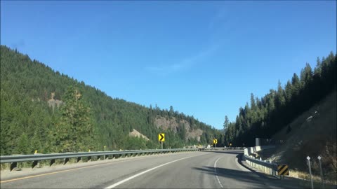
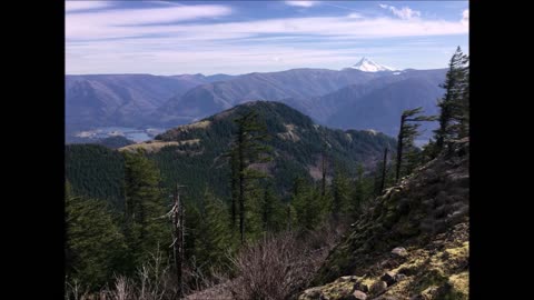
Interstate 90 - Beautiful Montana Highway (Lookout Pass Area)
Lookout Pass is a mountain pass in the Rocky Mountains of the northwestern United States. In the Coeur d'Alene Mountains of the Bitterroot Range, the pass is on the border between Idaho and Montana, traversed by Interstate 90 (formerly U.S. Route 10) at an elevation of 4,710 feet (1,436 m) above sea level.
Lookout Pass is the eastern border of northern Idaho's Silver Valley, and has the distinction of being "Exit 0" on Interstate 90 in Montana. Established 89 years ago in 1935, Lookout Pass Ski and Recreation Area is on the eastbound side of the highway, straddling the border. The state border line is the ridge line of the mountains and at the pass runs briefly east–west, with Idaho on the north side and Montana the south.
The pass separates the communities of Mullan in Shoshone County, Idaho, and Saltese in Mineral County, Montana. It is the highest point on Interstate 90 between Seattle and Missoula. The pass is also a time zone border, with northern Idaho on Pacific Time and Montana on Mountain Time. Eastbound on I-90, its elevation is not surpassed until beyond Deer Lodge.
Savatage - Morning Sun
Sirens
Power of the Night
Fight for the Rock
Hall of the Mountain King
Gutter Ballet
Streets: A Rock Opera
Edge of Thorns
Handful of Rain
Dead Winter Dead
The Wake of Magellan
Poets and Madmen
Savatage is an American heavy metal band founded by brothers Jon and Criss Oliva in 1979 in Tarpon Springs, Florida. The band was first called Avatar, but, shortly before the release of their debut album Sirens (1983), they changed their name to Savatage, as Avatar was already taken by another band. Savatage is considered a significant member of the American heavy metal movement of the early-to-mid-1980s and has been cited as a key influence on many genres, such as power metal, progressive metal, speed metal, thrash metal, death metal and symphonic metal. Beatles
Savatage has released eleven studio albums, two live albums, four compilations and three EPs. The band first reached substantial commercial success with its third studio album Fight for the Rock (1986), which peaked at number 158 on the Billboard 200. Its next four albums—Hall of the Mountain King (1987), Gutter Ballet (1989), Streets: A Rock Opera (1991) and Edge of Thorns (1993)—were also successful but more critically acclaimed than Fight for the Rock. On October 17, 1993, six months after the release of Edge of Thorns, guitarist Criss Oliva was killed in a car accident. Following his death, Jon (along with producer Paul O'Neill) decided to continue Savatage in memory of his brother. The band released four more studio albums, Handful of Rain, Dead Winter Dead, The Wake of Magellan, Poets & Madmen, and went through several line-up changes before going on an extended hiatus in 2002. During the years—partly even before the hiatus—members founded various new bands such as Jon Oliva's Pain, Trans-Siberian Orchestra, Circle II Circle and Doctor Butcher. On August 2, 2014, Savatage announced that they were reuniting for the 2015 Wacken Open Air; despite having discussed the possibility of more shows and new music, the band went on hiatus once again. Although Savatage technically remains inactive, half of the members of the band claimed in interviews during throughout 2020 and 2021 that they have been working on new material for a possible follow-up to Poets and Madmen (2001). Music on Rumble Music Rumble Get it together Rumble Beatles
25
views
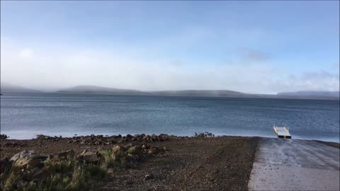
Liffey Falls, Pine Lake, Great Lake (Tasmania, Australia Hiking) 2019
Video and photos taken on May 28, 2019 in Tasmania, Australia
Nazareth - Every Time It Rains
Nestled in an area of cool, temperate rainforest, the Liffey Falls State Reserve is an easy one-hour drive from Launceston. The main attraction of the Reserve is Liffey Falls themselves, nevertheless you can also find spectacular tall trees, plentiful wildlife and numerous small walks within this scenic corner of the Tasmanian Wilderness World Heritage Area.
85
views
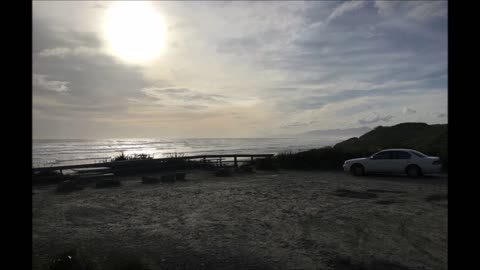
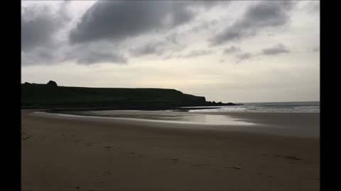
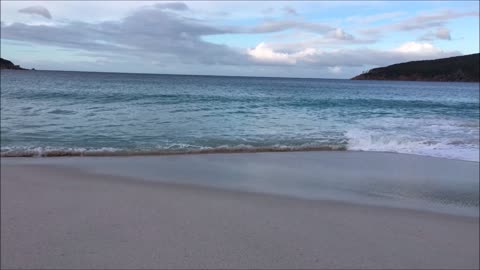
Ocean Beach Hike - (Strahan, Tasmania) Video & Slideshow
Ocean Beach footage recorded May, 23, 2019
Ocean Beach is a long stretch of beach located on the West Coast of Tasmania. It runs north of Macquarie Heads and Hells Gates, and is close to Strahan and parallel to the Strahan Airport runway. It extends as far north as Trial Harbour and the coast immediately west of Zeehan
69
views
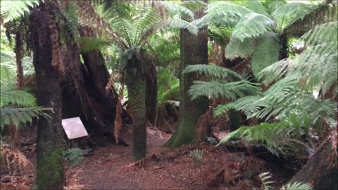
Weldborough Pass Rainforest Walk (Tasmania, Australia) Video
Nice easy going walk in the Northeast section of Tasmania on May 21, 2019
The Weldborough Pass Rainforest Walk is a short bushwalk in northeast Tasmania, Australia. It is an accessible way to see the myrtles and treeferns that make Tasmania’s cool temperate rainforest so distinctive.
Navigating in the general direction of the walk was easy – just drive the Tasman Highway between Weldborough and the junction to Lottah Road. While the highway was sealed for its entire length, it had some tight curves. Respect any yellow signs recommending low speeds around hairpin bends, even if the recommended speed is as low as 25 km/h.
The car park for the walk was on the south side of the highway. Signs in both directions warned of “Weldborough Pass Rainforest Walk 200m,” but it would still be easy to miss.
2
views
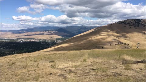
Barmeyer Loop Trail Viewpoint (Missoula, Montana) 2018
Fleetwood Mac - The Chain
Short video with photo's. Nice short hike just south of town. The trailhead is off Pattee Canyon Road.
7
views
Mount Wellington Hike (Tasmania, Australia) 2019
Mount Wellington was captured on May 30, 2019
Van Halen - Love Walks In
Mount Wellington is a mountain in the southeast of Tasmania, Australia. It is the summit of the Wellington Range and is within Wellington Park reserve. Hobart, Tasmania's capital city, is located at the foot of the mountain.
The mountain rises to 1,271 meters (4,170 ft) above sea level and is frequently covered by snow, sometimes even in summer, and the lower slopes are thickly forested, but crisscrossed by many walking tracks and a few fire trails. There is also a sealed narrow road to the summit, about 22 kilometers (14 mi) from Hobart central business district. An enclosed lookout near the summit has views of the city below and to the east, the Derwent estuary, and also glimpses of the World Heritage Area nearly 100 kilometers (62 mi) west. From Hobart, the most distinctive feature of Mount Wellington is the cliff of dolerite columns known as the Organ Pipes.
89
views
Mount Rainier - Three Chickens and a Bear (Wonderland Trail 2018)
Heading down the hill to North Puyallup River Camp.
Mount Rainier is a large active stratovolcano in the Cascade Range of the Pacific Northwest. The mountain is located in Mount Rainier National Park about 59 miles (95 km) south-southeast of Seattle. With a summit elevation of 14,411 ft (4,392 m), it is the highest mountain in the U.S. state of Washington and the Cascade Range, the most topographically prominent mountain in the contiguous United States, and the tallest in the Cascade Volcanic Arc.
Due to its high probability of eruption in the near future, Mount Rainier is considered one of the most dangerous volcanoes in the world (Bull crap scare tactic), and it is on the Decade Volcano list. The large amount of glacial ice means that Mount Rainier could produce massive lahars that “could” threaten the entire Puyallup River valley.
Between 1950 and 2018, 439,460 people climbed Mount Rainier.
The Wonderland Trail is an approximately 93-mile (150 km) hiking trail that circumnavigates Mount Rainier in Mount Rainier National Park, Washington, United States. The trail offers spectacular unique views on a daily basis and goes over many ridges of Mount Rainier for a cumulative 22,000 feet (6,700 m) of elevation gain. The trail was built in 1915. In 1981, it was designated a National Recreation Trail. An estimated 200 to 250 people a year complete the entire trail with several thousand others doing shorter sections of it. The average time taken to complete the entire trip is 10 to 14 days.
Longmire
Sunrise
Mowich Lake
White River
Summerland
Indian Bar
Nickle Creek
Reflection Lakes
Indian Henry’s
Emerald Ridge
South Puyallup
Spray Park
Grand Park
Devil’s Dream
Windy Gap
Northern Loop
Mowich River
Golden Lakes
Kautz
South Tahoma-Tahoma
Puyallup
North Mowich
Summit
Carbon
Winthrop
77
views
Mt. Rainier - Wonderland Trail 2010 (Slideshow)
Great Hike and Scenery
Nazareth - Morning Dew
Mount Rainier is a large active stratovolcano in the Cascade Range of the Pacific Northwest. The mountain is located in Mount Rainier National Park about 59 miles (95 km) south-southeast of Seattle. With a summit elevation of 14,411 ft (4,392 m), it is the highest mountain in the U.S. state of Washington and the Cascade Range, the most topographically prominent mountain in the contiguous United States, and the tallest in the Cascade Volcanic Arc.
Due to its high probability of eruption in the near future, Mount Rainier is considered one of the most dangerous volcanoes in the world (Bull crap scare tactic), and it is on the Decade Volcano list. The large amount of glacial ice means that Mount Rainier could produce massive lahars that “could” threaten the entire Puyallup River valley.
Between 1950 and 2018, 439,460 people climbed Mount Rainier.
The Wonderland Trail is an approximately 93-mile (150 km) hiking trail that circumnavigates Mount Rainier in Mount Rainier National Park, Washington, United States. The trail offers spectacular unique views on a daily basis and goes over many ridges of Mount Rainier for a cumulative 22,000 feet (6,700 m) of elevation gain. The trail was built in 1915. In 1981, it was designated a National Recreation Trail. An estimated 200 to 250 people a year complete the entire trail with several thousand others doing shorter sections of it. The average time taken to complete the entire trip is 10 to 14 days.
Longmire
Sunrise
Mowich Lake
White River
Summerland
Indian Bar
Nickle Creek
Reflection Lakes
Indian Henry’s
Emerald Ridge
South Puyallup
Spray Park
Grand Park
Devil’s Dream
Windy Gap
Northern Loop
Mowich River
Golden Lakes
Kautz
South Tahoma-Tahoma
Puyallup
North Mowich
Summit
Carbon
Winthrop
92
views
Mt Rainier - Panhandle Gap, Indian Bar Hiking
Wire - Villain Plays The Victim
Awesome Mt. Rainier Hiking
Hard Rockin' Song
Wire - Villain Plays The Victim
Mount Rainier is a large active stratovolcano in the Cascade Range of the Pacific Northwest. The mountain is located in Mount Rainier National Park about 59 miles (95 km) south-southeast of Seattle. With a summit elevation of 14,411 ft (4,392 m), it is the highest mountain in the U.S. state of Washington and the Cascade Range, the most topographically prominent mountain in the contiguous United States, and the tallest in the Cascade Volcanic Arc.
Due to its high probability of eruption in the near future, Mount Rainier is considered one of the most dangerous volcanoes in the world (Bull crap scare tactic), and it is on the Decade Volcano list. The large amount of glacial ice means that Mount Rainier could produce massive lahars that “could” threaten the entire Puyallup River valley.
Between 1950 and 2018, 439,460 people climbed Mount Rainier.
The Wonderland Trail is an approximately 93-mile (150 km) hiking trail that circumnavigates Mount Rainier in Mount Rainier National Park, Washington, United States. The trail offers spectacular unique views on a daily basis and goes over many ridges of Mount Rainier for a cumulative 22,000 feet (6,700 m) of elevation gain. The trail was built in 1915. In 1981, it was designated a National Recreation Trail. An estimated 200 to 250 people a year complete the entire trail with several thousand others doing shorter sections of it. The average time taken to complete the entire trip is 10 to 14 days.
Longmire
Sunrise
Mowich Lake
White River
Summerland
Indian Bar
Nickle Creek
Reflection Lakes
Indian Henry’s
Emerald Ridge
South Puyallup
Spray Park
Grand Park
Devil’s Dream
Windy Gap
Northern Loop
Mowich River
Golden Lakes
Kautz
South Tahoma-Tahoma
Puyallup
North Mowich
Summit
Carbon
Winthrop
367
views
The Nut (Hiking in Stanley, Tasmania) Australia
May 25, 2019 in Stanley, Tasmania
Frankie Miller - Sail Away
The Nut is a volcanic plug near the town of Stanley, Tasmania. It is made of fragments of basaltic volcanic rock from a volcano that was active about 25–70 million years ago. It has an elevation of 143 metres (469 ft) above sea level.
The areas around it are culturally significant to the local Tarkine Aboriginal people because of stone formations, middens, quarries and artefact scatters near the area.
The European discovery of the Nut was made by George Bass and Matthew Flinders when they circumnavigated Tasmania in the sloop Norfolk. The origins of its name are speculated to be from the Tasmanian Aboriginal name, "munatrik" or because explosives were unable to dent it during the construction of a breakwater. Australia
Hiking
Bowl
spoon
Cup & Plate
Jumper Cables
Elevation
Altitude
Valley
Forest
Knife
Moleskin
Tennis Ball
Rain Gear
Stuff sack
Rain Jacket
Rain Pants
Pack cover
tent sleep items
Pillow
Pair of socks
Hat
Gloves
Long Johns
Long sleeve shirt
extra underwear
camelback
Water Filter purifying tablets
Powder Gatorade
Vitamins
Towel
Toothbrush
Toothpaste
Chap stick
Soap
Bugs
sunscreen
Headlamp
Whistle
Sunglasses
Lighter
Matches
Supplies
Pack
Tent
Sleeping Bag
Sleeping Pad
Boots or Hiking Tennis shoes
Sit Pad
Hiking stick
Map
Sandals
All The Food
Water bottle
Glaciers
Rivers
Mountains
Dust
Dirt
Trail
Track
Hike
Backpack
Overnight
Rope Food
Tourist
Travel
503
views
South Cape Hike (Tasmania, Australia) May 29, 2019
Southern tip of the world!
Great hike in Southwest National Park, Tasmania
DREAMS - Van Halen
Badlands South Dakota
Mount Rainier
Wonderland Trail
Hamilton Mountain
Beacon Rock
Great Lake
Tasmania, Australia Hiking
Ocean Beach Hike
Weldborough Pass Rainforest
Barmeyer Loop
Missoula, Montana
Mount Wellington
The Nut Stanley, Tasmania
South Cape
Eagle
Columbia River Gorge
Wineglass Bay
Silver Star Mountain
Cradle Mountain
Camelback Mountain
Arizona
Washington
Pinnacle Peak
Mt. Rainier
#VideoStudios
Video Studios
One News Page
#OneNewsPage
Shorts
Hiking shirt Sleeveless
1 wool or polyester sweater
garbage bags
straps
extra stuff sacks
space blanket
Bowl
spoon
Cup & Plate
Jumper Cables
Elevation
Altitude
Valley
Forest
Knife
Moleskin
Tennis Ball
Rain Gear
Stuff sack
Rain Jacket
Rain Pants
Pack cover
tent sleep items
Pillow
Pair of socks
Hat
Gloves
Long Johns
Long sleeve shirt
extra underwear
camelback
Water Filter purifying tablets
Powder Gatorade
Vitamins
Towel
Toothbrush
Toothpaste
Chap stick
Soap
Bugs
sunscreen
Headlamp
Whistle
Sunglasses
Lighter
Matches
Supplies
Pack
Tent
Sleeping Bag
Sleeping Pad
Boots or Hiking Tennis shoes
Sit Pad
Hiking stick
Map
Sandals
All The Food
Water bottle
Glaciers
Rivers
Mountains
Dust
Dirt
Trail
Track
Hike
Backpack
Overnight
Rope Food
180
views
Mount Rainier - Eagle's Roost Lookout (Wonderland Trail 2018)
Short clip with a great view!
Mount Rainier is a large active stratovolcano in the Cascade Range of the Pacific Northwest. The mountain is located in Mount Rainier National Park about 59 miles (95 km) south-southeast of Seattle. With a summit elevation of 14,411 ft (4,392 m), it is the highest mountain in the U.S. state of Washington and the Cascade Range, the most topographically prominent mountain in the contiguous United States, and the tallest in the Cascade Volcanic Arc.
Due to its high probability of eruption in the near future, Mount Rainier is considered one of the most dangerous volcanoes in the world (Bull crap scare tactic), and it is on the Decade Volcano list. The large amount of glacial ice means that Mount Rainier could produce massive lahars that “could” threaten the entire Puyallup River valley.
Between 1950 and 2018, 439,460 people climbed Mount Rainier.
The Wonderland Trail is an approximately 93-mile (150 km) hiking trail that circumnavigates Mount Rainier in Mount Rainier National Park, Washington, United States. The trail offers spectacular unique views on a daily basis and goes over many ridges of Mount Rainier for a cumulative 22,000 feet (6,700 m) of elevation gain. The trail was built in 1915. In 1981, it was designated a National Recreation Trail. An estimated 200 to 250 people a year complete the entire trail with several thousand others doing shorter sections of it. The average time taken to complete the entire trip is 10 to 14 days.
Longmire
Sunrise
Mowich Lake
White River
Summerland
Indian Bar
Nickle Creek
Reflection Lakes
Indian Henry’s
Emerald Ridge
South Puyallup
Spray Park
Grand Park
Devil’s Dream
Windy Gap
Northern Loop
Mowich River
Golden Lakes
Kautz
South Tahoma-Tahoma
Puyallup
North Mowich
Summit
Carbon
Winthrop
18
views
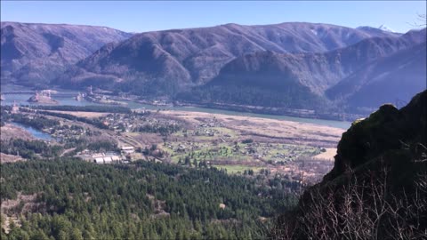
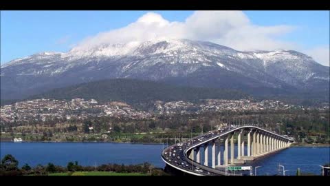
Columbia River Gorge Area (Southwest Washington)
Sammy Hagar - Eagles Fly
Bells Mountain Trail Washington
Hardy Ridge Trail Washington
Angel's Rest Trail in Oregon
8
views
Wineglass Bay Hike - (Tasmania, Australia)
What a great hike that day!
Scorpions - Always Somewhere
Experience a taste of the wild south on this delightful extended walk. Leave from the southern-most road in Australia and walk through woodland and open bush till you reach the cliff above South Cape Bay. It’s a rare day when the wind isn’t howling and the surf roaring at this breath-taking place. If conditions allow, take the steps down to the beach. There you can wander the sand and cobble beach as far as Lion Rock, and marvel at what the wild ocean has washed up. A few things attracted me to this walk. First, the lure of a geographical extremity - it provides access to the southernmost tip of Tasmania. Second, it forms the first (or last) section of the South Coast Track - one of Australia's greatest and most difficult wilderness treks. I'd love to walk the whole track but probably never will, so being able to walk a small piece of it was a sort of second prize. Tasmania
The other attraction, to me at least, was that most walking guides describe the track as "easy". In a mountainous state like Tasmania, many walks can feel challenging to an ageing and unfit dude like me. Walks of an easier standard therefore get my attention. I don't think "easy" is entirely accurate, as I'll describe later, but compared to other walks I suppose it is.
Getting there is a treat in itself. About 120km or two hours from Hobart, it's as far south as you can drive in Australia. I set out from from Dover, and south of there the drive is mainly through forests and near quiet inlets with a growing sense of remoteness. Arriving at Cockle Creek has a real end-of-the-road feeling, which is appropriate because it literally is the end of the road.
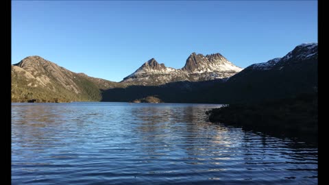
Cradle Mountain is a locality and mountain in the Central Highlands region of the Australian state of Tasmania. The mountain is situated in the Cradle Mountain-Lake St Clair National Park.
At 1,545 metres (5,069 ft) above sea level, it is the sixth-highest mountain in Tasmania.[1]
The locality of Cradle Mountain is a rural locality in the local government areas of Meander Valley, Kentish and West Coast in the Launceston and North-west and west local government regions of Tasmania. The locality is about 109 kilometres (68 mi) west of the town of Westbury. The 2016 census has a population of 66 for the state suburb of Cradle Mountain. Cradle Mountain was gazetted as a locality in 1966. Cradle Mountain (the mountain) occupies a small area in the north-west of the locality, which occupies the northern half of Cradle Mountain-Lake St Clair National Park. Route C132 (Cradle Mountain Road / Dove Lake Road) enters from the north and runs south to Dove Lake, where it ends.
The area is covered in a variety of alpine and sub-alpine vegetation, including the colourful deciduous beech, itself an anomaly given that most Australian native flora is evergreen. Alpine coral fern and button grass dominate the alpine wet sedgelands near the mountain summit. Stands of Tasmanian snow gum can be found at slightly lower elevations alongside Tasmanian eyebright, scoparia heath, mountain rocket, waratah, Cheshunt pine and pencil pine. Within the valleys surrounding the mountain, species such as myrtle beech, pandani, sassafras, King Billy pine and celery top pine form thick temperate rainforest with dense, mossy undergrowth.
Fungi are also a part of the park's biodiversity. While the Management Plan from 1999 for Cradle Mountain-Lake St Clair National Park only mentions fungi in the context of their destructive effects (Phytophthora cinnamomi and Chalara australis), the park has a variety of fungi that perform beneficial ecological roles. Parasitic fungi—often regarded negatively—are a vital part of healthy ecosystems, regulating ecosystem functions.
As primary recyclers of organic matter, saprobic fungi break down fallen branches and leaf litter, making vital nutrients available to other organisms. Other fungi form symbiotic relationships with other organisms. Although rarely acknowledged, the great majority of plants in Cradle Mountain-Lake St Clair National Park (and, indeed, in the world) form mutually beneficial mycorrhizal relationships with fungi.
Given the diversity of plants, specialist habitats and micro-climates in the park, a diversity of fungi, including lichens, is also expected to occur. Several hundred species have already been recorded by field naturalists and interested individuals and can be found in the Atlas of Living Australia.
Despite their essential roles in underpinning terrestrial ecosystems, fungi are barely recognised as a vital part of Australia's biodiversity. Although Australia has national and state level biodiversity conservation strategies and has ratified international conventions, most overlook fungi, including Tasmania's Natural Heritage Strategy, which only makes one generic reference to fungi.
One of the more a conspicuous species found in the wetter parts of the park is the strawberry bracket fungus (Tyromyces pulcherrimus). It grows on myrtle beech (Nothofagus cunninghammii) and snow gums. The Australian citizen-science organisation, Fungimap is documenting and mapping the distribution of fungi including those that occur in national parks
Badlands South Dakota
Mount Rainier
Wonderland Trail
Hamilton Mountain
Beacon Rock
Great Lake
Tasmania, Australia Hiking
Ocean Beach Hike
Weldborough Pass Rainforest
Barmeyer Loop
Missoula, Montana
Mount Wellington
The Nut Stanley, Tasmania
South Cape
Eagle
Columbia River Gorge
Wineglass Bay
Silver Star Mountain
Cradle Mountain
Camelback Mountain
Arizona
Washington
Pinnacle Peak
Mt. Rainier
#VideoStudios
Video Studios
One News Page
#OneNewsPage
Shorts
Hiking shirt Sleeveless
1 wool or polyester sweater
garbage bags
straps
extra stuff sacks
space blanket
Bowl
spoon
Cup & Plate
Jumper Cables
Elevation
Altitude
Valley
Forest
Knife
Moleskin
Tennis Ball
Rain Gear
Stuff sack
Rain Jacket
Rain Pants
Pack cover
tent sleep items
Pillow
Pair of socks
Hat
Gloves
Long Johns
Long sleeve shirt
extra underwear
camelback
Water Filter purifying tablets
Powder Gatorade
Vitamins
Towel
Toothbrush
Toothpaste
Chap stick
Soap
Bugs
sunscreen
Headlamp
Whistle
Sunglasses
Lighter
Matches
Supplies
Pack
Tent
Sleeping Bag
Sleeping Pad
Boots or Hiking Tennis shoes
Sit Pad
Hiking stick
Map
Sandals
All The Food
Water bottle
Glaciers
Rivers
Mountains
Dust
Dirt
Trail
Track
Hike
Backpack
Overnight
Rope Food
190
views
Silver Star Mountain (Washington State)
July 15, 2020
Highly recommended hike in Southwest Washington.
Music by Ted Nugent
Stranglehold
Shorts
Hiking shirt Sleeveless
1 wool or polyester sweater
garbage bags
straps
extra stuff sacks
space blanket
Bowl
spoon
Cup & Plate
Jumper Cables
Elevation
Altitude
Valley
Forest
Knife
Moleskin
Tennis Ball
Rain Gear
Stuff sack
Rain Jacket
Rain Pants
Pack cover
tent sleep items
Pillow
Pair of socks
Hat
Gloves
Long Johns
Long sleeve shirt
extra underwear
camelback
Water Filter purifying tablets
Powder Gatorade
Vitamins
Towel
Toothbrush
Toothpaste
Chap stick
Soap
Bugs
sunscreen
Headlamp
Whistle
Sunglasses
Lighter
Matches
Supplies
Pack
Tent
Sleeping Bag
Sleeping Pad
Boots or Hiking Tennis shoes
Sit Pad
Hiking stick
Map
Sandals
All The Food
Water bottle
Glaciers
Rivers
Mountains
Dust
Dirt
Trail
Track
Hike
Backpack
Overnight
Rope Food
199
views
Cradle Mountain Hike (Tasmania, Australia)
Awesome Hiking at Cradle Mountain, Tasmania (2 Hikes)
Cradle Mountain is a locality and mountain in the Central Highlands region of the Australian state of Tasmania. The mountain is situated in the Cradle Mountain-Lake St Clair National Park.
At 1,545 metres (5,069 ft) above sea level, it is the sixth-highest mountain in Tasmania.[1]
The locality of Cradle Mountain is a rural locality in the local government areas of Meander Valley, Kentish and West Coast in the Launceston and North-west and west local government regions of Tasmania. The locality is about 109 kilometres (68 mi) west of the town of Westbury. The 2016 census has a population of 66 for the state suburb of Cradle Mountain. Cradle Mountain was gazetted as a locality in 1966. Cradle Mountain (the mountain) occupies a small area in the north-west of the locality, which occupies the northern half of Cradle Mountain-Lake St Clair National Park. Route C132 (Cradle Mountain Road / Dove Lake Road) enters from the north and runs south to Dove Lake, where it ends.
The area is covered in a variety of alpine and sub-alpine vegetation, including the colourful deciduous beech, itself an anomaly given that most Australian native flora is evergreen. Alpine coral fern and button grass dominate the alpine wet sedgelands near the mountain summit. Stands of Tasmanian snow gum can be found at slightly lower elevations alongside Tasmanian eyebright, scoparia heath, mountain rocket, waratah, Cheshunt pine and pencil pine. Within the valleys surrounding the mountain, species such as myrtle beech, pandani, sassafras, King Billy pine and celery top pine form thick temperate rainforest with dense, mossy undergrowth.
Fungi are also a part of the park's biodiversity. While the Management Plan from 1999 for Cradle Mountain-Lake St Clair National Park only mentions fungi in the context of their destructive effects (Phytophthora cinnamomi and Chalara australis), the park has a variety of fungi that perform beneficial ecological roles. Parasitic fungi—often regarded negatively—are a vital part of healthy ecosystems, regulating ecosystem functions.
As primary recyclers of organic matter, saprobic fungi break down fallen branches and leaf litter, making vital nutrients available to other organisms. Other fungi form symbiotic relationships with other organisms. Although rarely acknowledged, the great majority of plants in Cradle Mountain-Lake St Clair National Park (and, indeed, in the world) form mutually beneficial mycorrhizal relationships with fungi.
Given the diversity of plants, specialist habitats and micro-climates in the park, a diversity of fungi, including lichens, is also expected to occur. Several hundred species have already been recorded by field naturalists and interested individuals and can be found in the Atlas of Living Australia.
Despite their essential roles in underpinning terrestrial ecosystems, fungi are barely recognised as a vital part of Australia's biodiversity. Although Australia has national and state level biodiversity conservation strategies and has ratified international conventions, most overlook fungi, including Tasmania's Natural Heritage Strategy, which only makes one generic reference to fungi.
One of the more a conspicuous species found in the wetter parts of the park is the strawberry bracket fungus (Tyromyces pulcherrimus). It grows on myrtle beech (Nothofagus cunninghammii) and snow gums. The Australian citizen-science organisation, Fungimap is documenting and mapping the distribution of fungi including those that occur in national parks
Badlands South Dakota
Mount Rainier
Wonderland Trail
Hamilton Mountain
Beacon Rock
Great Lake
Tasmania, Australia Hiking
Ocean Beach Hike
Weldborough Pass Rainforest
Barmeyer Loop
Missoula, Montana
Mount Wellington
The Nut Stanley, Tasmania
South Cape
Eagle
Columbia River Gorge
Wineglass Bay
Silver Star Mountain
Cradle Mountain
Camelback Mountain
Arizona
Washington
Pinnacle Peak
Mt. Rainier
#VideoStudios
Video Studios
One News Page
#OneNewsPage
Shorts
Hiking shirt Sleeveless
1 wool or polyester sweater
garbage bags
straps
extra stuff sacks
space blanket
Bowl
spoon
Cup & Plate
Jumper Cables
Elevation
Altitude
Valley
Forest
Knife
Moleskin
Tennis Ball
Rain Gear
Stuff sack
Rain Jacket
Rain Pants
Pack cover
tent sleep items
Pillow
Pair of socks
Hat
Gloves
Long Johns
Long sleeve shirt
extra underwear
camelback
Water Filter purifying tablets
Powder Gatorade
Vitamins
Towel
Toothbrush
Toothpaste
Chap stick
Soap
Bugs
sunscreen
Headlamp
Whistle
Sunglasses
Lighter
Matches
Supplies
Pack
Tent
Sleeping Bag
Sleeping Pad
Boots or Hiking Tennis shoes
Sit Pad
Hiking stick
Map
Sandals
All The Food
Water bottle
Glaciers
Rivers
Mountains
Dust
Dirt
Trail
Track
Hike
Backpack
Overnight
Rope Food
662
views
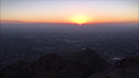
Camelback Mountain Hike January 9, 2021
Camelback Mountain is a mountain in Phoenix, Arizona, United States. The English name is derived from its shape, which resembles the hump and head of a kneeling camel. The mountain, a prominent landmark of the Phoenix metropolitan area, is located in the Camelback Mountain Echo Canyon Recreation Area between the Arcadia neighborhood of Phoenix and the town of Paradise Valley. It is a popular recreation destination for hiking and rock climbing.
Two hiking trails ascend 1,280 feet (390 m) to the peak of Camelback Mountain. The Echo Canyon Trail is 1.14 miles (1900 m) and the Cholla Trail is 1.4 mi (2300 m). Both trails are considered strenuous with steep grades. The hiking path has dirt, gravel, boulders, and some handrail-assisted sections. The average hike requires a round trip time of 1.5 to 3 hours.
The Praying Monk is a red sandstone rock formation which is used for rock climbing. Located on the northern slope, the formation resembles the silhouette of a person kneeling in prayer. It rises approximately 100 feet (30 m) and the eastern face has several permanent anchor bolts for attaching a belay rope.
275
views
Mt Rainier - Pinnacle Peak Hike October 1, 2021
Trailhead was at the Reflection Lakes viewing area!
Mount Rainier is a large active stratovolcano in the Cascade Range of the Pacific Northwest. The mountain is located in Mount Rainier National Park about 59 miles (95 km) south-southeast of Seattle. With a summit elevation of 14,411 ft (4,392 m), it is the highest mountain in the U.S. state of Washington and the Cascade Range, the most topographically prominent mountain in the contiguous United States, and the tallest in the Cascade Volcanic Arc.
Due to its high probability of eruption in the near future, Mount Rainier is considered one of the most dangerous volcanoes in the world (Bull crap scare tactic), and it is on the Decade Volcano list. The large amount of glacial ice means that Mount Rainier could produce massive lahars that “could” threaten the entire Puyallup River valley.
Between 1950 and 2018, 439,460 people climbed Mount Rainier.
The Wonderland Trail is an approximately 93-mile (150 km) hiking trail that circumnavigates Mount Rainier in Mount Rainier National Park, Washington, United States. The trail offers spectacular unique views on a daily basis and goes over many ridges of Mount Rainier for a cumulative 22,000 feet (6,700 m) of elevation gain. The trail was built in 1915. In 1981, it was designated a National Recreation Trail. An estimated 200 to 250 people a year complete the entire trail with several thousand others doing shorter sections of it. The average time taken to complete the entire trip is 10 to 14 days.
Longmire
Sunrise
Mowich Lake
White River
Summerland
Indian Bar
Nickle Creek
Reflection Lakes
Indian Henry’s
Emerald Ridge
South Puyallup
Spray Park
Grand Park
Devil’s Dream
Windy Gap
Northern Loop
Mowich River
Golden Lakes
Kautz
South Tahoma-Tahoma
Puyallup
North Mowich
Summit
Carbon
Winthrop
673
views
6
comments